Description island Ada BojanaThe uninhabited small island of Ada Bojana is part of (the island group) and is located in the country of , Southern Europe. The distance to the mainland is, quite close about 0.1 km. The surface-area of the island is 4.9 km2 and is therefore 0.013 x times greater than the island of Isle of Wight. The island lies in the and the total coastal length is about 10.2 km and the dimensions of the island are approximately 3.1 km by 2.9 km (maximum width). The island is Northeast - Southwest oriented. The coordinates (latitude, longitude) of the island (center) for GPS are 41.86 (41°51'42.9840), 19.36 (19°21'34.8840).It is located in the administrative unit (local administrative level-name ), in the (local administrative level-name ). Direct neighboring islands of Ada Bojana are (distance from central part island to central part of the neighboring islands): 1) Katič Located 49.4 km SouthEast of the island. 2) Sveta Neđelja Located 49.6 km SouthEast of the island. 3) Sveti Nikola Located 58.9 km SouthEast of the island. 4) Sveti Marko Located 79.9 km SouthEast of the island. 5) Gospa od Milosti Located 81.4 km SouthEast of the island. 6) Mamula Located 87.1 km SouthEast of the island. 7) Kolocep Located 140.2 km SouthEast of the island. 8) Lopud Located 144.3 km SouthEast of the island. 9) Šipan Located 149.9 km SouthEast of the island. 10) Mljet Located 159.7 km SouthEast of the island. 11) Korcula Located 211.3 km SouthEast of the island. 12) Lastovo Located 221.2 km SouthSouthEast of the island. 13) Hvar Located 224.9 km SouthEast of the island. 14) Corfu Located 228.4 km West of the island. 15) Isole Cheradi Located 240.4 km SouthWest of the island. 16) Proizd Located 255.4 km SouthSouthEast of the island. 17) Brac Located 255.9 km SouthEast of the island. 18) Palagruža Located 260.8 km SouthSouthEast of the island. 19) Sveti Klement Located 280.6 km SouthSouthEast of the island. 20) Vis Located 285.9 km SouthSouthEast of the island. 21) Šolta Located 290.9 km SouthEast of the island. 22) Paxoi Located 295.8 km WestNorthWest of the island. 23) Biševo Located 299 km SouthSouthEast of the island. 24) Ciovo Located 301.3 km SouthEast of the island. 25) Drvenik Veli Located 312.8 km SouthEast of the island. The source material on the island consists of sand. The land use on the island of Ada Bojana consists of Sand - Rock 0.1 km2 (3%), nature 4.8 km2 (95%), To return to the overview page of this island click on the following link: Overview island Ada Bojana |
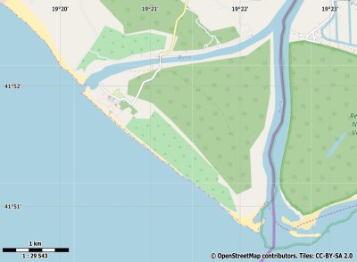
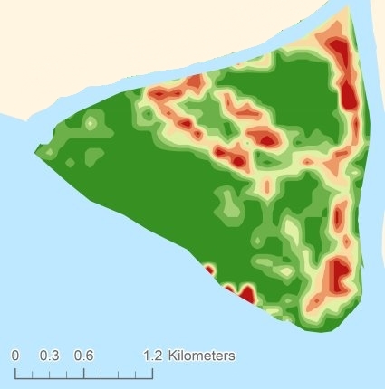
Topographic islandmap Ada Bojana © OpenStreetMap-auteurs, CC-BY-SA. Map Ada Bojana Ada Bojana views: 212 Height map of Ada Bojana |


