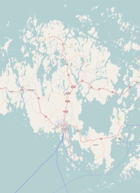
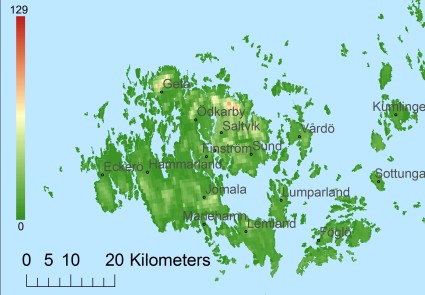
Description island Åland (Fasta)The inhabited large island of Åland (Fasta) (local name Ahvenanmaa) is part of (the island group) Åland Islands and is located in the country of Finland, Northern Europe. The distance to the mainland is about 44.3 km. The nearest (main) land is Sweden and is not the country to which the island belongs. The surface-area of the island is 807.8 km2 and is therefore 2.1 x times greater than the island of Isle of Wight. The island lies in the Gulf of Bothnia and the total coastal length is about 849.2 km and the dimensions of the island are approximately 60 km by 40 km (maximum width). The island is West-northwest - South-southeast oriented. The highest point is 129 meter and is named Orrdals klint. The coordinates (latitude, longitude) of the island (center) for GPS are 60.26 (60°1'32.0736), 19.94 (19°56'24.5076).The population is 28065 and the population density is thus on 18.08 inhabitants per square kilometer (compared Isle of Wight 364 inhabitants / km²). The capital of the island is Mariehamn (located in the South of the island). Other places on the island are: Godby (M). The island is located in the South-southwest of the country Finland. It is located in the administrative unit Region Åland (local administrative level-name maakunta), in the municipalities : 1) Jomala 2) Hammarland 3) Eckerö 4) Finström 5) Geta 6) Saltvik 7) Sund 8) Lemland 9) Lumparland 10) Vårdö 11) Kumlinge 12) Brändö 13) Sottunga 14) Föglö 15) Kökar (local administrative level-name Kommun). Direct neighboring islands of Åland are (distance from central part island to central part of the neighboring islands): 1) Singö Located 47.5 km SouthSouthWest of the island. 2) Houtskär Located 55 km North of the island. 3) Keistiö Located 57 km North of the island. 4) Gräsö Located 57.6 km South of the island. 5) Korpo Located 66.6 km North of the island. 6) Utö Located 67.7 km NorthNorthWest of the island. 7) Norrskata Located 70.3 km North of the island. 8) Storlandet Located 77.2 km North of the island. 9) Möja Located 85.7 km WestSouthWest of the island. 10) Grinda Located 100.7 km SouthWest of the island. 11) Runmarö Located 103.4 km WestSouthWest of the island. 12) Nämdö Located 113.6 km WestSouthWest of the island. 13) Ornö Located 129.9 km SouthWest of the island. 14) Utö Located 146.6 km WestSouthWest of the island. 15) Hiiumaa Located 155.7 km NorthWest of the island. 16) Gotska Sandön Located 183.6 km WestSouthWest of the island. 17) Saaremaa Located 189.3 km WestNorthWest of the island. 18) Osmussaar Located 192.8 km NorthNorthWest of the island. 19) Vormsi Located 195.9 km NorthNorthWest of the island. 20) Vilsandi Located 199.4 km WestNorthWest of the island. 21) Suur-Pakri Located 217.1 km NorthNorthWest of the island. 22) Väike-Pakri Located 220.9 km NorthNorthWest of the island. 23) Muhu Located 221.7 km NorthWest of the island. 24) Fårö Located 226 km WestSouthWest of the island. 25) Gotland Located 237.8 km WestSouthWest of the island. The island is accessible by car (by means of ferry or bridge). The distance from Western-Europe (The Netherlands) is about 1677 km. There is a ferry connection for cars to the mainland. For pedestrians, there is a ferry connection to the mainland also. Far as is known, there are good cycling opportunities on the island. The source material on the island consists of rocky surface. The land use on the island of Åland consists of wood 495.5 km2 (61%), nature 98.9 km2 (12%), and agriculture 182.8 km2 (23%), To return to the overview page of this island click on the following link: Overview island Åland (Fasta) |
Topographic islandmap Åland (Fasta) © OpenStreetMap-auteurs, CC-BY-SA. Map Åland Åland (Fasta) views: 1615 Height map of Åland (Fasta) |


