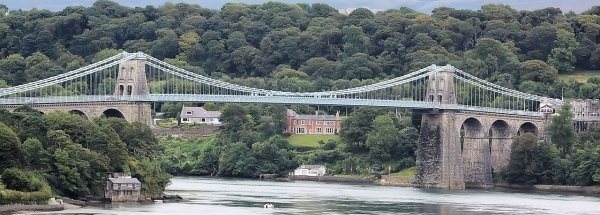
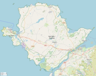
Description island AngleseyThe inhabited large island of Anglesey (local name Ynys Môn ) is part of (the island group) Anglesey and is located in the country of Great Britain , Western Europe. The distance to the mainland is, quite close about 0.4 km. The surface-area of the island is 673.5 km2 and is therefore 1.8 x times greater than the island of Isle of Wight. The island lies in the Irish Sea and the total coastal length is about 197.1 km and the dimensions of the island are approximately 44 km by 34 km (maximum width). The island is West - East oriented. The highest point is 170 meter. The coordinates (latitude, longitude) of the island (center) for GPS are 53.25 (53°17'1.6692), -4.36 (-4°21'26.1468).The population is 68600 and the population density is thus on 96.00 inhabitants per square kilometer (compared Isle of Wight 364 inhabitants / km²). The capital of the island is Llangefni (located in the Center of the island). Other places on the island are: Llannerch-y-medd (M). The island is located in the Center of the country Great Britain . It is located in the administrative unit County Isle of Anglesey (local administrative level-name county), Direct neighboring islands of Anglesey are (distance from central part island to central part of the neighboring islands): 1) Holy Island Located 0.1 km WestSouthWest of the island. 2) Bardsey Island Located 47.8 km WestSouthWest of the island. 3) Man Located 70.8 km East of the island. 4) Lambay Located 94.9 km South of the island. 5) Ramsey Island Located 153 km WestSouthWest of the island. 6) Skomer Island Located 165.9 km WestSouthWest of the island. 7) Caldey Island Located 167.1 km West of the island. 8) Skokholm Island Located 169.7 km WestSouthWest of the island. 9) Lundy Located 215.6 km West of the island. 10) Arran Located 227.9 km East of the island. 11) Rathlin Island Located 231.2 km EastSouthEast of the island. 12) Holy Island Located 235.3 km East of the island. 13) Isle of Bute Located 257.8 km East of the island. 14) Great Cumbrae Island Located 259.4 km East of the island. 15) Gigha Located 260.8 km EastSouthEast of the island. 16) Islay Located 265.5 km EastSouthEast of the island. 17) Jura Located 280.4 km EastSouthEast of the island. 18) Holy Island Located 297.3 km EastNorthEast of the island. 19) Inner Farne Located 298.2 km EastNorthEast of the island. 20) Staple Island Located 300.6 km EastNorthEast of the island. 21) Oronsay Located 308.3 km EastSouthEast of the island. 22) Aran Located 309.3 km SouthEast of the island. 23) Colonsay Located 310.3 km EastSouthEast of the island. 24) Tory Located 312.7 km SouthEast of the island. 25) Scarba Located 314.6 km EastSouthEast of the island. The island is accessible by car (by means of ferry or bridge). The distance from Western-Europe (The Netherlands) is about 842 km. There is a ferry connection for cars to the mainland. For pedestrians, there is a ferry connection to the mainland also. Far as is known, there are good cycling opportunities on the island. The source material on the island consists of rocky surface. The land use on the island of Anglesey consists of Sand - Rock 11.2 km2 (2%), wood 18.1 km2 (3%), nature 33.7 km2 (5%), wet nature 8.7 km2 (1%), and agriculture 568 km2 (84%), To return to the overview page of this island click on the following link: Overview island Anglesey |
|


