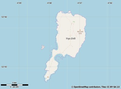
Description island Bardsey IslandThe inhabited very small island of Bardsey Island is part of (the island group) and is located in the country of , Western Europe. The distance to the mainland is, quite close about 2.9 km. The surface-area of the island is 1.8 km2 and is therefore 0.005 x times greater than the island of Isle of Wight. The island lies in the and the total coastal length is about 7.1 km and the dimensions of the island are approximately 2.7 km by 1.2 km (maximum width). The island is West-southwest - East-northeast oriented. The coordinates (latitude, longitude) of the island (center) for GPS are 52.76 (52°45'36.5148), -4.79 (-4°4'45.3468).The population is 0 and the population density is thus on 0.00 inhabitants per square kilometer (compared Isle of Wight 364 inhabitants / km²). The island is located in the of the country . It is located in the administrative unit (local administrative level-name ), in the (local administrative level-name ). Direct neighboring islands of Bardsey Island are (distance from central part island to central part of the neighboring islands): 1) Anglesey Located 47.8 km EastNorthEast of the island. 2) Holy Island Located 54.4 km EastNorthEast of the island. 3) Ramsey Island Located 103.1 km WestSouthWest of the island. 4) Lambay Located 113.7 km SouthEast of the island. 5) Skomer Island Located 116.5 km WestSouthWest of the island. 6) Skokholm Island Located 120.4 km WestSouthWest of the island. 7) Caldey Island Located 122.9 km West of the island. 8) Man Located 143.6 km East of the island. 9) Lundy Located 172 km West of the island. 10) Rathlin Island Located 291.6 km EastSouthEast of the island. 11) Arran Located 297.7 km East of the island. 12) Brownsea Island Located 300.1 km NorthWest of the island. 13) Holy Island Located 305.9 km East of the island. 14) Inisheer Located 317.8 km South of the island. 15) Isle of Wight Located 320.6 km NorthWest of the island. 16) Inishmaan Located 322.2 km South of the island. 17) St Martins Located 325.5 km WestSouthWest of the island. 18) Gigha Located 326.4 km East of the island. 19) Inishmore Located 326.8 km South of the island. 20) Islay Located 327.2 km EastSouthEast of the island. 21) Tresco Located 327.3 km WestSouthWest of the island. 22) Bryher Located 328 km WestSouthWest of the island. 23) Isle of Bute Located 329 km East of the island. 24) Gorumna Located 329.3 km South of the island. 25) St Marys Located 329.4 km WestSouthWest of the island. The source material on the island consists of rocky surface. The land use on the island of Bardsey Island consists of nature 1.4 km2 (78%), To return to the overview page of this island click on the following link: Overview island Bardsey Island |
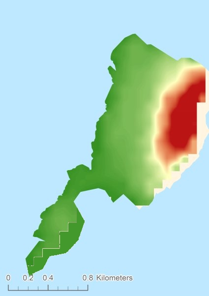
Topographic islandmap Bardsey Island © OpenStreetMap-auteurs, CC-BY-SA. Map Bardsey Island Bardsey Island views: 260 Height map of Bardsey Island |


