Description island BornholmThe inhabited large island of Bornholm is located in the country of Denmark, Northern Europe. The distance to the mainland is about 35.3 km. The nearest (main) land is Sweden and is not the country to which the island belongs. The surface-area of the island is 589.9 km2 and is therefore 1.6 x times greater than the island of Isle of Wight. The island lies in the Baltic Sea and the total coastal length is about 122.3 km and the dimensions of the island are approximately 40 km by 30 km (maximum width). The island is West-northwest - East-southeast oriented. The highest point is 162 meter and is named Rytterknægten. The coordinates (latitude, longitude) of the island (center) for GPS are 55.12 (55°7'29.5968), 14.91 (14°54'38.3508).The population is 39572 and the population density is thus on 67.25 inhabitants per square kilometer (compared Isle of Wight 364 inhabitants / km²). The capital of the island is Rønne (located in the Southwest of the island). Other places on the island are: Rønne, Knudsker, Vestermarie, Nylarsker, Nyker, Hasle, Rutsker, Olsker, Allinge-Sandvig, Klemensker, Rø, Ibsker, Svaneke, Østerlarsker, Gudhjem, Østermarie, Christiansø, Aaker, Bodilsker, Nexø, Poulsker, Pedersker. The island is located in the East-southeast of the country Denmark. It is located in the administrative unit Capital Region of Denmark (local administrative level-name region), in the municipality Bornholm (local administrative level-name Kommune). Direct neighboring islands of Bornholm are (distance from central part island to central part of the neighboring islands): 1) Hanö Located 78.2 km East of the island. 2) Rügen Located 87.6 km SouthWest of the island. 3) Ivö Located 89.5 km EastSouthEast of the island. 4) Aspö Located 101 km EastNorthEast of the island. 5) Utlängan Located 101.7 km NorthEast of the island. 6) Sturkö Located 103.4 km EastNorthEast of the island. 7) Wolin Located 108.9 km West of the island. 8) Chrząszczewska Wyspa Located 114.3 km West of the island. 9) Usedom Located 116.3 km WestSouthWest of the island. 10) Saltholm Located 129.3 km SouthSouthEast of the island. 11) Amager Located 134.9 km SouthSouthEast of the island. 12) Møn Located 136.9 km South of the island. 13) Öland Located 141.3 km NorthEast of the island. 14) Seeland Located 142.9 km SouthSouthEast of the island. 15) Ven Located 144.9 km SouthSouthEast of the island. 16) Nyord Located 156.3 km South of the island. 17) Falster Located 163.8 km South of the island. 18) Bogø Located 166.7 km South of the island. 19) Lolland Located 184.6 km South of the island. 20) Hallands Väderö Located 186.6 km SouthEast of the island. 21) Bolmsö Located 189.1 km EastSouthEast of the island. 22) Orø Located 191.3 km SouthSouthEast of the island. 23) Femø Located 199.6 km South of the island. 24) Fejø Located 206.1 km South of the island. 25) Agersø Located 221.2 km South of the island. The island is accessible by car (by means of ferry or bridge). The distance from Western-Europe (The Netherlands) is about 954 km. There is a ferry connection for cars to the mainland. For pedestrians, there is a ferry connection to the mainland also. Far as is known, there are good cycling opportunities on the island. The land use on the island of Bornholm consists of wood 94.2 km2 (16%), nature 6.9 km2 (1%), and agriculture 446.3 km2 (76%), To return to the overview page of this island click on the following link: Overview island Bornholm |
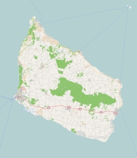
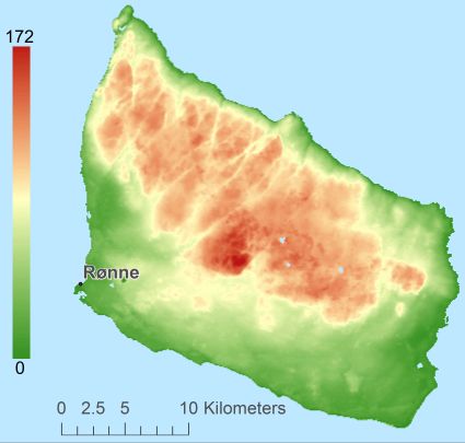
Topographic islandmap Bornholm © OpenStreetMap-auteurs, CC-BY-SA. Map Bornholm Bornholm views: 2042 Height map of Bornholm |


