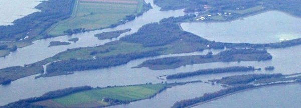
Description island BuisjesThe uninhabited very small island of Buisjes is part of (the island group) Biesbosch-islands and is located in the country of The Netherlands, Western Europe. The surface-area of the island is 0.220 km2 and is therefore 0.001 x times greater than the island of Isle of Wight. The island lies in the Biesbosch and the total coastal length is about 2.5 km and the length of the island is about km. The highest point is only 3 meter. The coordinates (latitude, longitude) of the island (center) for GPS are 51.75 (51°44'45.5856), 4.77 (4°45'56.9592).It is located in the administrative unit Province North Brabant (local administrative level-name Provincie), in the Municipality Drimmelen (local administrative level-name Gemeente). Direct neighboring islands of Buisjes are (distance from central part island to central part of the neighboring islands): 1) Hennipje Located 0.2 km WestNorthWest of the island. 2) Rietplaat Located 0.3 km North of the island. 3) Vischplaat Located 0.5 km West of the island. 4) Boerenplaat Located 2.6 km SouthWest of the island. 5) Tiengemeten Located 27.6 km South of the island. 6) Noordplaat Located 38.5 km SouthSouthWest of the island. 7) Slijkplaat Located 41.8 km South of the island. 8) Middenplaat Located 42.8 km SouthSouthEast of the island. 9) Eiland in Krabbenkreek Located 43.6 km SouthSouthWest of the island. 10) Prinsesseplaat Located 44.8 km SouthWest of the island. 11) Steenvliet Located 46.8 km SouthWest of the island. 12) Meent Located 51.1 km EastNorthEast of the island. 13) Veermansplaat Located 51.2 km South of the island. 14) Kabeljauwplaat Located 51.8 km South of the island. 15) Geitekaai Located 52.5 km EastNorthEast of the island. 16) Markus Pos Located 53.6 km EastNorthEast of the island. 17) Robinson Crusoë Located 54.1 km EastNorthEast of the island. 18) Stampersplaat Zuid Located 54.6 km South of the island. 19) Hompelvoet Located 54.8 km South of the island. 20) Markenje Located 54.8 km South of the island. 21) Stampersplaat Located 55 km South of the island. 22) Dwars in den Weg Located 56.9 km South of the island. 23) Het Verdronken Land van Saeftinghe Located 60.2 km SouthWest of the island. 24) Ossehoek Located 60.3 km South of the island. 25) Schelphoekplaten Located 70.6 km SouthSouthWest of the island. The land use on the island of Buisjes consists of wet nature 0.2 km2 (91%), To return to the overview page of this island click on the following link: Overview island Buisjes |
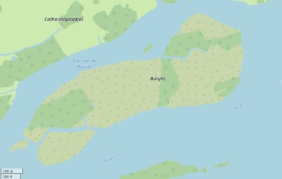
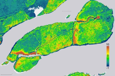
Topographic islandmap Buisjes © OpenStreetMap-auteurs, CC-BY-SA. Map Buisjes Buisjes views: 754 Height map of Buisjes |


