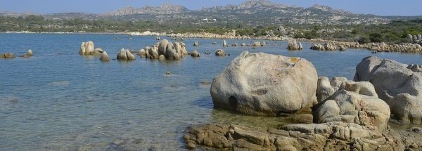
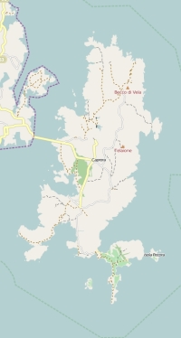
Description island CapreraThe uninhabited small island of Caprera is part of (the island group) Sardinia and is located in the country of Italy, Southern Europe. The distance to the mainland is about 185.6 km. The surface-area of the island is 15.5 km2 and is therefore 0.041 x times greater than the island of Isle of Wight. The island lies in the Tyrrhenian Sea and the total coastal length is about 58.7 km and the dimensions of the island are approximately 8.8 km by 3.5 km (maximum width). The island is North - South oriented. The highest point is 212 meter and is named Monte Teialone. The coordinates (latitude, longitude) of the island (center) for GPS are 41.21 (41°12'36.1692), 9.46 (9°27'52.0812).It is located in the administrative unit Region Sardinia (local administrative level-name regione), in the Province Olbia-Tempio (local administrative level-name Provincia ). Direct neighboring islands of Caprera are (distance from central part island to central part of the neighboring islands): 1) La maddalena Located 0.6 km SouthSouthEast of the island. 2) Sardinia Located 1.2 km SouthSouthWest of the island. 3) Île Cavallo Located 20.6 km SouthEast of the island. 4) Corsica Located 24.2 km SouthEast of the island. 5) Tavolara Located 34.9 km NorthWest of the island. 6) Molara Located 38.5 km WestNorthWest of the island. 7) Asinara Located 91.6 km South of the island. 8) Montecristo Located 137.2 km EastNorthEast of the island. 9) Pianosa Located 155.2 km EastNorthEast of the island. 10) Del Giglio Located 169 km NorthEast of the island. 11) Elba Located 173.9 km EastNorthEast of the island. 12) Giannutri Located 174.6 km NorthEast of the island. 13) Capraia Located 197.1 km East of the island. 14) Isola di San Pietro Located 241.1 km WestSouthWest of the island. 15) Gorgona Located 244.1 km East of the island. 16) Isola di Sant'Antioco Located 245.4 km WestSouthWest of the island. 17) Isola Bisentina Located 250.1 km NorthEast of the island. 18) Isola Martana Located 251.3 km NorthEast of the island. 19) Palmarola Located 284.3 km North of the island. 20) Di Ponza Located 292.4 km North of the island. 21) Gavi Located 296.6 km North of the island. 22) Isola Zannone Located 300.3 km North of the island. 23) Isola Polvese Located 302.4 km NorthEast of the island. 24) Isola Maggiore Located 304.2 km NorthEast of the island. 25) Isola Minore Located 305.2 km NorthEast of the island. The island is accessible by car (by means of ferry or bridge). The distance from Western-Europe (The Netherlands) is about 1630 km. For pedestrians, there is a ferry connection to the mainland also. There are ferry connections with car to other (neighboring) island (s). There are also (seasonal) ferry connections for pedestrians (-cyclists) with other (neighboring) island(s). Far as is known, there are good cycling opportunities on the island. The source material on the island consists of rocky surface. The land use on the island of Caprera consists of Sand - Rock 1.1 km2 (7%), wood 1.3 km2 (8%), nature 11.9 km2 (77%), To return to the overview page of this island click on the following link: Overview island Caprera |
|


