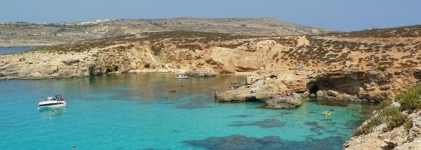
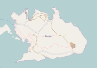
Description island CominoThe inhabited small island of Comino (local name Kemmuna) is part of (the island group) Malta - country and is located in the country of Malta, Southern Europe. The distance to the mainland is about 245 km. The nearest (main) land is Italy and is not the country to which the island belongs. The surface-area of the island is 2.7 km2 and is therefore 0.007 x times greater than the island of Isle of Wight. The island lies in the Mediterranean Sea and the total coastal length is about 9.5 km and the dimensions of the island are approximately 2.6 km by 2.2 km (maximum width). The island is West - East oriented. The highest point is 75 meter and is named Redoubt Hill. The coordinates (latitude, longitude) of the island (center) for GPS are 36.01 (36°0'42.1956), 14.34 (14°20'9.6972).The population is 8 and the population density is thus on 2.00 inhabitants per square kilometer (compared Isle of Wight 364 inhabitants / km²). The island is located in the Northwest of the country Malta. It is located in the administrative unit Local council Ghajnsielem (local administrative level-name Kunsill Lokali), Direct neighboring islands of Comino are (distance from central part island to central part of the neighboring islands): 1) Gozo Located 0.8 km EastSouthEast of the island. 2) Malta Located 1.6 km West of the island. 3) Islands of St. Paul Located 6.4 km NorthWest of the island. 4) Sicily Located 83.9 km EastNorthEast of the island. 5) Linosa Located 131 km South of the island. 6) Lampedusa Located 162.3 km SouthSouthWest of the island. 7) Lampione Located 187.9 km SouthSouthWest of the island. 8) Pantelleria Located 219.5 km SouthSouthEast of the island. 9) Vulcano Located 266.7 km EastNorthEast of the island. 10) Isola di Favignana Located 272.5 km SouthEast of the island. 11) Lipari Located 273.9 km East of the island. 12) Alicudi Located 278.6 km East of the island. 13) Isola di Levanzo Located 280.3 km SouthEast of the island. 14) Filicudi Located 282 km East of the island. 15) Salina Located 282.8 km East of the island. 16) Isola di Marettimo Located 292 km SouthEast of the island. 17) Panarea Located 295.9 km EastNorthEast of the island. 18) Ustica Located 313.5 km EastSouthEast of the island. 19) Stromboli Located 315.1 km EastNorthEast of the island. 20) Capri Located 501.4 km East of the island. 21) Ischia Located 520 km East of the island. 22) Procida Located 524.6 km East of the island. 23) Santo Stefano Located 534.7 km East of the island. 24) Ventotene Located 534.9 km East of the island. 25) Sardinia Located 544.3 km SouthEast of the island. There are ferry connections with car to other (neighboring) island (s). There are also (seasonal) ferry connections for pedestrians (-cyclists) with other (neighboring) island(s). The source material on the island consists of rocky surface. The land use on the island of Comino consists of nature 1.2 km2 (42%), To return to the overview page of this island click on the following link: Overview island Comino |
|


