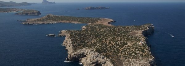
Description island ConejeraThe uninhabited very small island of Conejera (local name Isla Conejera) is part of (the island group) Balearic Islands and is located in the country of Spain, Southern Europe. The distance to the mainland is about 88.5 km. The surface-area of the island is 1.1 km2 and is therefore 0.003 x times greater than the island of Isle of Wight. The island lies in the Balearic Sea and the total coastal length is about 6.8 km and the dimensions of the island are approximately 2.1 km by 0.70 km (maximum width). The island is North - South oriented. The coordinates (latitude, longitude) of the island (center) for GPS are 38.99 (38°59'0.6954), 1.21 (1°12'41.2272).It is located in the administrative unit Autonomous Community Balearic Islands (local administrative level-name Comunidad autónoma), in the Province Balearic Islands (local administrative level-name Provincia). Direct neighboring islands of Conejera are (distance from central part island to central part of the neighboring islands): 1) Ibiza Located 1 km NorthNorthWest of the island. 2) Vedrà Located 11.7 km West of the island. 3) Espalmador Located 26.7 km NorthWest of the island. 4) Formentera Located 29.5 km NorthWest of the island. 5) Espardell Located 29.6 km NorthWest of the island. 6) Tagomago Located 36.8 km North of the island. 7) Islas Columbretes Located 109.5 km EastSouthEast of the island. 8) Dragonera Located 113.8 km NorthEast of the island. 9) Mallorca Located 115.7 km NorthNorthEast of the island. 10) Benidorm Island Located 127.6 km SouthSouthWest of the island. 11) Cabrera Located 147.9 km North of the island. 12) Conejera Located 152 km North of the island. 13) Tabarca Located 171.6 km SouthSouthWest of the island. 14) Isla Mayor o del Baron Located 223.6 km SouthWest of the island. 15) Menorca Located 246.9 km NorthNorthEast of the island. 16) Illa den Colom Located 284 km NorthNorthEast of the island. 17) Medes Islands Located 379 km EastNorthEast of the island. 18) Isla de Alboran Located 504.2 km SouthWest of the island. 19) Isla del Rey Located 530.6 km SouthWest of the island. 20) Isla de Isabel II Located 530.9 km SouthWest of the island. 21) Isla del Congreso Located 531.6 km SouthWest of the island. 22) Pheasant Island Located 543.6 km EastSouthEast of the island. 23) Santa Clara eiland Located 550.8 km EastSouthEast of the island. 24) Île Pomègues Located 584.2 km NorthEast of the island. 25) Île Ratonneau Located 586 km NorthEast of the island. The land use on the island of Conejera consists of nature 1 km2 (95%), To return to the overview page of this island click on the following link: Overview island Conejera |
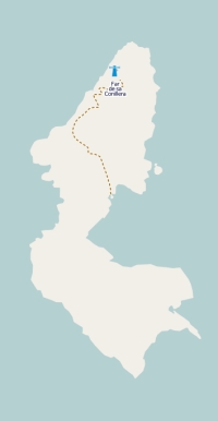
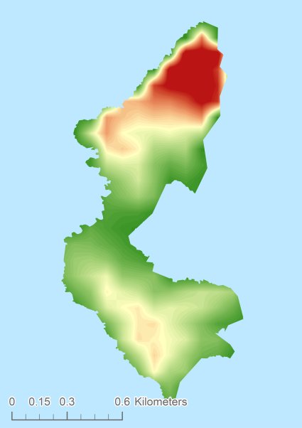
Topographic islandmap Conejera © OpenStreetMap-auteurs, CC-BY-SA. Map Conejera Conejera views: 873 Height map of Conejera |


