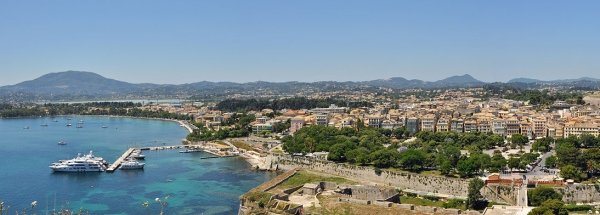
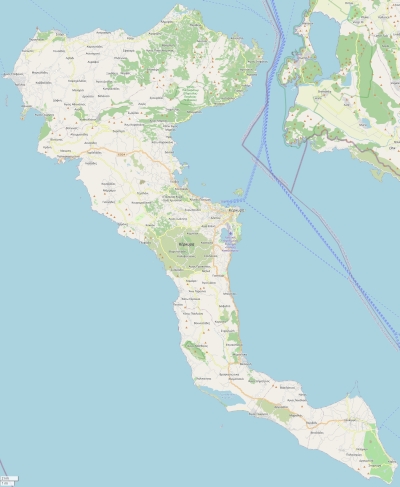
Description island CorfuThe inhabited large island of Corfu (local name Κέρκυρα) is part of (the island group) Ionian Islands and is located in the country of Greece, Southern Europe. The distance to the mainland is, quite close about 2 km. The nearest (main) land is Albania and is not the country to which the island belongs. The surface-area of the island is 595.5 km2 and is therefore 1.6 x times greater than the island of Isle of Wight. The island lies in the Ionian Sea and the total coastal length is about 211.8 km and the dimensions of the island are approximately 64 km by 32 km (maximum width). The island is Northwest - Southeast oriented. The highest point is 906 meter and is named Pantokrator. The coordinates (latitude, longitude) of the island (center) for GPS are 39.63 (39°38'3.9264), 19.85 (19°50'46.6728).The population is 109537 and the population density is thus on 179.00 inhabitants per square kilometer (compared Isle of Wight 364 inhabitants / km²). The capital of the island is Korfoe - Kerkyra (located in the East of the island). Other places on the island are: Sidari (N), Rodha (N), Palaiokastritsa (NW), Korfoe (O), Agios Gordios (W), Moraitika (Z), Kavos (Z). The island is located in the West of the country Greece. It is located in the administrative unit Region Ionian Islands (local administrative level-name Periféreia - περιοχή ), in the Regional unit Corfu (local administrative level-name Nomos - Πειραιάς). Direct neighboring islands of Korfoe are (distance from central part island to central part of the neighboring islands): 1) Paxoi Located 12.9 km West of the island. 2) Lefkas Located 75 km NorthWest of the island. 3) Meganisi Located 94.5 km NorthWest of the island. 4) Kalamos Located 105.1 km NorthWest of the island. 5) Kefalonia Located 105.5 km WestNorthWest of the island. 6) Ithaki Located 106.2 km WestNorthWest of the island. 7) Zakynthos Located 166.7 km WestNorthWest of the island. 8) Isole Cheradi Located 223.6 km SouthSouthEast of the island. 9) Ada Bojana Located 228.4 km East of the island. 10) Euboea Located 242.2 km NorthNorthWest of the island. 11) Katič Located 273.1 km EastSouthEast of the island. 12) Sveta Neđelja Located 273.4 km EastSouthEast of the island. 13) Sveti Nikola Located 281.5 km EastSouthEast of the island. 14) Nisida Skiauos Located 282.8 km North of the island. 15) Skopelos Located 299.7 km North of the island. 16) Sveti Marko Located 300.8 km EastSouthEast of the island. 17) Gospa od Milosti Located 301.7 km EastSouthEast of the island. 18) Mamula Located 302.9 km EastSouthEast of the island. 19) Alonnisos Located 320.9 km North of the island. 20) Salamina Located 326 km NorthNorthWest of the island. 21) Kyra Panagia Located 337.8 km North of the island. 22) Aigina Located 338.6 km NorthNorthWest of the island. 23) Kolocep Located 346.7 km EastSouthEast of the island. 24) Lopud Located 349.9 km EastSouthEast of the island. 25) Poros Located 353.8 km NorthWest of the island. Note: The information described below is partly subject to change. The island is directly accessible from Western Europe by plane. An international airport is present on the island. The island is accessible by car (by means of ferry or bridge). The distance from Western-Europe (The Netherlands) is about 2326 km. There is a ferry connection for cars to the mainland. For pedestrians, there is a ferry connection to the mainland also. There are ferry connections with car to other (neighboring) island (s). There are also (seasonal) ferry connections for pedestrians (-cyclists) with other (neighboring) island(s). Far as is known, there are good cycling opportunities on the island. To return to the overview page of this island click on the following link: Overview island Corfu |
|


