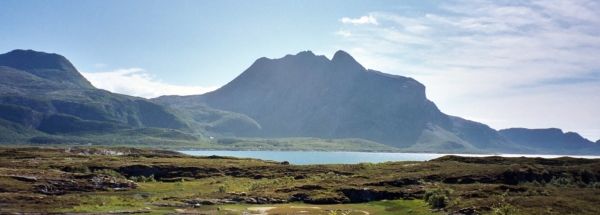
Description island DønnaThe inhabited fairly large island of Dønna is part of (the island group) and is located in the country of , Northern Europe. The distance to the mainland is, quite close about 2.6 km. The surface-area of the island is 133.3 km2 and is therefore 0.351 x times greater than the island of Isle of Wight. The island lies in the and the total coastal length is about 266 km and the dimensions of the island are approximately 26.8 km by 12.8 km (maximum width). The island is West-southwest - East-northeast oriented. The coordinates (latitude, longitude) of the island (center) for GPS are 66.1 (66°6'15.4728), 12.51 (12°30'34.6932).The population is 1410 and the population density is thus on 7.60 inhabitants per square kilometer (compared Isle of Wight 364 inhabitants / km²). The capital of the island is Solfjellsjøen (located in the West of the island). Other places on the island are: Donnes (N), Glein (O). The island is located in the of the country . It is located in the administrative unit (local administrative level-name ), in the (local administrative level-name ). Direct neighboring islands of Dønna are (distance from central part island to central part of the neighboring islands): 1) Løkta Located 1.7 km NorthNorthEast of the island. 2) Alsta Located 5 km WestNorthWest of the island. 3) Tomma Located 5 km NorthEast of the island. 4) Lurøya Located 23.2 km EastNorthEast of the island. 5) Nesøya Located 35.8 km East of the island. 6) Vega Located 36.8 km WestSouthWest of the island. 7) Husøya Located 37 km SouthEast of the island. 8) Åmnøya Located 65.6 km EastNorthEast of the island. 9) Meløya Located 73.1 km EastNorthEast of the island. 10) Leka Located 102 km WestSouthWest of the island. 11) Fugløya Located 104.5 km EastNorthEast of the island. 12) Sandhornøya Located 111.7 km NorthEast of the island. 13) Røst Located 144.3 km East of the island. 14) Landegode Located 146.5 km EastNorthEast of the island. 15) Værøy Located 156.4 km East of the island. 16) Mosken Located 168.6 km East of the island. 17) Moskenesøya Located 178.4 km East of the island. 18) Flakstadøya Located 199.6 km East of the island. 19) Vestvågøya Located 207.8 km East of the island. 20) Engeløya Located 214.5 km EastNorthEast of the island. 21) Lundøya Located 224.4 km EastNorthEast of the island. 22) Austvågøy Located 227.6 km EastNorthEast of the island. 23) Gimsøya Located 236.7 km EastNorthEast of the island. 24) Linesøya Located 246.4 km WestSouthWest of the island. 25) Hinnøya Located 253.6 km EastNorthEast of the island. The source material on the island consists of rocky surface. The land use on the island of Dønna consists of Sand - Rock 1.7 km2 (1%), wood 24.2 km2 (18%), nature 91.8 km2 (69%), wet nature 9.1 km2 (7%), and agriculture 5.2 km2 (4%), To return to the overview page of this island click on the following link: Overview island Dønna |
|


