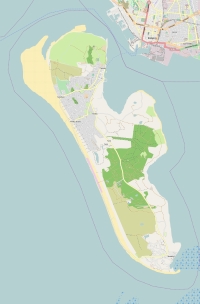
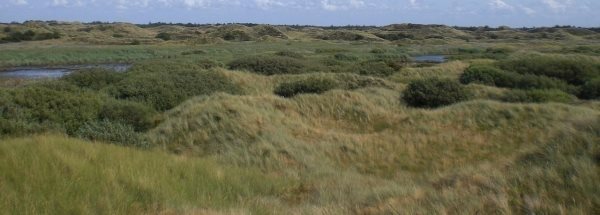
Description island FanøThe inhabited fairly large island of Fanø is part of (the island group) Wadden Islands and is located in the country of Denmark, Northern Europe. The distance to the mainland is, quite close about 1.1 km. The nearest (main) land is Germany and is not the country to which the island belongs. The surface-area of the island is 58.7 km2 and is therefore 0.155 x times greater than the island of Isle of Wight. The island lies in the North Sea and the total coastal length is about 48.3 km and the dimensions of the island are approximately 16 km by 5.2 km (maximum width). The island is Northwest - Southeast oriented. The highest point is 21 meter and is named Pælebjerg. The coordinates (latitude, longitude) of the island (center) for GPS are 55.41 (55°24'3.7278), 8.41 (8°24'43.6248).The population is 3251 and the population density is thus on 58.00 inhabitants per square kilometer (compared Isle of Wight 364 inhabitants / km²). The capital of the island is Nordby (located in the North-northeast of the island). Other places on the island are: Rindby, S. The island is located in the West-southwest of the country Denmark. It is located in the administrative unit Region of Southern Denmark (local administrative level-name region), in the municipality Fanø (local administrative level-name Kommune). Direct neighboring islands of Fanø are (distance from central part island to central part of the neighboring islands): 1) Mandø Located 6.8 km NorthWest of the island. 2) Rømø Located 14.3 km West of the island. 3) Sylt Located 31.5 km West of the island. 4) Föhr Located 64.9 km West of the island. 5) Amrum Located 69.9 km West of the island. 6) Funen Located 77.5 km North of the island. 7) Als Located 80.7 km NorthNorthWest of the island. 8) Bågø Located 83.3 km North of the island. 9) Pellworm Located 88 km West of the island. 10) Lyø Located 109.6 km NorthNorthWest of the island. 11) Ærø Located 117.6 km NorthNorthWest of the island. 12) Endelave Located 117.8 km NorthNorthEast of the island. 13) Vendsyssel-Thy Located 123.7 km East of the island. 14) Heligoland-Düne Located 132.6 km WestSouthWest of the island. 15) Heligoland Located 133.4 km WestSouthWest of the island. 16) Mors Located 134.5 km East of the island. 17) Tåsinge Located 134.9 km NorthNorthWest of the island. 18) Samsø Located 136.8 km NorthNorthEast of the island. 19) Langeland Located 146.4 km NorthNorthWest of the island. 20) Fur Located 152.6 km EastNorthEast of the island. 21) Seeland Located 156 km NorthNorthEast of the island. 22) Lolland Located 168 km NorthNorthWest of the island. 23) Omø Located 170.1 km North of the island. 24) Agersø Located 171.3 km North of the island. 25) Sejerø Located 173.6 km NorthNorthEast of the island. The island is accessible by car (by means of ferry or bridge). The distance from Western-Europe (The Netherlands) is about 560 km. There is a ferry connection for cars to the mainland. For pedestrians, there is a ferry connection to the mainland also. Far as is known, there are good cycling opportunities on the island. The source material on the island consists of sand. The land use on the island of Fanø consists of Sand - Rock 8.1 km2 (14%), wood 9.7 km2 (17%), nature 17.5 km2 (30%), wet nature 8.7 km2 (15%), and agriculture 6 km2 (10%), To return to the overview page of this island click on the following link: Overview island Fanø |
Topographic islandmap Fanø © OpenStreetMap-auteurs, CC-BY-SA. Map Fanø Fanø views: 1140 Height map of Fanø |


