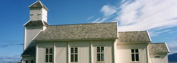
Description island GimsøyaThe inhabited small island of Gimsøya is part of (the island group) and is located in the country of , Northern Europe. The distance to the mainland is about 48.4 km. The surface-area of the island is 45 km2 and is therefore 0.118 x times greater than the island of Isle of Wight. The island lies in the and the total coastal length is about 67.2 km and the dimensions of the island are approximately 11 km by 6.6 km (maximum width). The island is Northwest - Southeast oriented. The coordinates (latitude, longitude) of the island (center) for GPS are 68.3 (68°17'56.4468), 14.18 (14°11'5.5572).The population is 230 and the population density is thus on 5.00 inhabitants per square kilometer (compared Isle of Wight 364 inhabitants / km²). The island is located in the of the country . It is located in the administrative unit (local administrative level-name ), in the (local administrative level-name ). Direct neighboring islands of Gimsøya are (distance from central part island to central part of the neighboring islands): 1) Vestvågøya Located 0.2 km SouthSouthWest of the island. 2) Austvågøy Located 0.7 km NorthNorthWest of the island. 3) Hadseløya Located 27.4 km NorthEast of the island. 4) Hinnøya Located 29.1 km North of the island. 5) Flakstadøya Located 30.8 km SouthWest of the island. 6) Langøya Located 31 km EastNorthEast of the island. 7) Moskenesøya Located 42.7 km SouthSouthWest of the island. 8) Engeløya Located 44.4 km NorthWest of the island. 9) Lundøya Located 47.4 km NorthNorthWest of the island. 10) Tjeldøya Located 75.3 km North of the island. 11) Andøya Located 79.3 km NorthEast of the island. 12) Mosken Located 81.2 km SouthWest of the island. 13) Værøy Located 87.7 km SouthWest of the island. 14) Landegode Located 90.9 km West of the island. 15) Grytøya Located 108.1 km NorthEast of the island. 16) Rolla Located 114.8 km NorthNorthEast of the island. 17) Sandhornøya Located 118 km West of the island. 18) Røst Located 118.2 km SouthWest of the island. 19) Fugløya Located 131.5 km West of the island. 20) Andørja Located 131.6 km NorthNorthEast of the island. 21) Senja Located 131.8 km NorthEast of the island. 22) Dyrøya Located 146.8 km NorthNorthEast of the island. 23) Meløya Located 159.9 km West of the island. 24) Åmnøya Located 167.7 km WestSouthWest of the island. 25) Nesøya Located 195.5 km WestSouthWest of the island. The source material on the island consists of rocky surface. The land use on the island of Gimsøya consists of Sand - Rock 1.2 km2 (3%), wood 2 km2 (5%), nature 18.5 km2 (41%), wet nature 16.3 km2 (36%), and agriculture 6.7 km2 (15%), To return to the overview page of this island click on the following link: Overview island Gimsøya |
|


