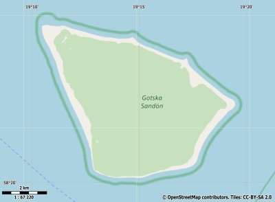
Description island Gotska SandönThe uninhabited small island of Gotska Sandön is part of (the island group) and is located in the country of , Northern Europe. The distance to the mainland is about 89.2 km. The surface-area of the island is 36.8 km2 and is therefore 0.097 x times greater than the island of Isle of Wight. The island lies in the and the total coastal length is about 25.2 km and the dimensions of the island are approximately 9.5 km by 6.2 km (maximum width). The island is Northwest - Southeast oriented. The coordinates (latitude, longitude) of the island (center) for GPS are 58.37 (58°21'57.2472), 19.25 (19°14'46.9212).It is located in the administrative unit (local administrative level-name ), in the (local administrative level-name ). Direct neighboring islands of Gotska Sandön are (distance from central part island to central part of the neighboring islands): 1) Fårö Located 37.5 km West of the island. 2) Gotland Located 47.9 km WestSouthWest of the island. 3) Utö Located 76.9 km SouthEast of the island. 4) Ornö Located 81.3 km EastSouthEast of the island. 5) Nämdö Located 91.3 km EastSouthEast of the island. 6) Runmarö Located 98.2 km EastSouthEast of the island. 7) Möja Located 113 km East of the island. 8) Grinda Located 117.2 km EastSouthEast of the island. 9) Vilsandi Located 145.3 km North of the island. 10) Saaremaa Located 146.8 km North of the island. 11) Öland Located 165.3 km SouthWest of the island. 12) Hiiumaa Located 169.6 km NorthNorthEast of the island. 13) Åland (Fasta) Located 183.6 km EastNorthEast of the island. 14) Abruka Located 186.8 km North of the island. 15) Utö Located 195.6 km NorthEast of the island. 16) Singö Located 196.5 km East of the island. 17) Gräsö Located 214.5 km East of the island. 18) Muhu Located 220 km North of the island. 19) Korpo Located 230.8 km EastNorthEast of the island. 20) Vormsi Located 231.5 km NorthNorthEast of the island. 21) Houtskär Located 232.2 km EastNorthEast of the island. 22) Ruhnu Located 237.5 km NorthNorthWest of the island. 23) Storlandet Located 238.3 km NorthEast of the island. 24) Norrskata Located 241.8 km EastNorthEast of the island. 25) Keistiö Located 248.3 km EastNorthEast of the island. The source material on the island consists of sand. The land use on the island of Gotska Sandön consists of Sand - Rock 4.1 km2 (11%), wood 32.5 km2 (88%), To return to the overview page of this island click on the following link: Overview island Gotska Sandön |
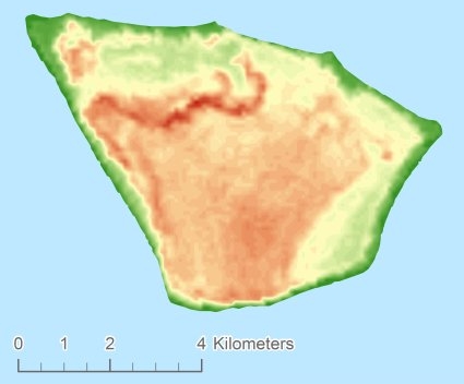
Topographic islandmap Gotska Sandön © OpenStreetMap-auteurs, CC-BY-SA. Map Gotska Sandön Gotska Sandön views: 312 Height map of Gotska Sandön |


