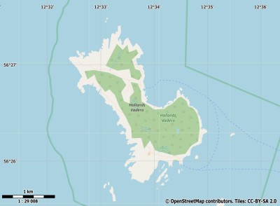
Description island Hallands VäderöThe uninhabited small island of Hallands Väderö is part of (the island group) and is located in the country of , Northern Europe. The distance to the mainland is, quite close about 2.8 km. The surface-area of the island is 3.1 km2 and is therefore 0.008 x times greater than the island of Isle of Wight. The island lies in the and the total coastal length is about 10.9 km and the dimensions of the island are approximately 2.9 km by 1.7 km (maximum width). The island is Northwest - Southeast oriented. The coordinates (latitude, longitude) of the island (center) for GPS are 56.44 (56°2'39.3972), 12.56 (12°33'45.3888).It is located in the administrative unit (local administrative level-name ), in the (local administrative level-name ). Direct neighboring islands of Hallands Väderö are (distance from central part island to central part of the neighboring islands): 1) Seeland Located 36.9 km WestSouthWest of the island. 2) Ven Located 57 km West of the island. 3) Anholt Located 62.3 km SouthSouthEast of the island. 4) Amager Located 81.5 km West of the island. 5) Orø Located 82.9 km WestSouthWest of the island. 6) Bolmsö Located 84.2 km NorthEast of the island. 7) Saltholm Located 85.3 km West of the island. 8) Sejerø Located 104.8 km SouthWest of the island. 9) Ivö Located 116.9 km NorthNorthWest of the island. 10) Læsø Located 124 km SouthEast of the island. 11) Samsø Located 129.7 km SouthSouthWest of the island. 12) Hanö Located 147.2 km NorthNorthWest of the island. 13) Vendsyssel-Thy Located 147.7 km SouthSouthEast of the island. 14) Funen Located 151 km SouthWest of the island. 15) Møn Located 153.6 km West of the island. 16) Nyord Located 153.8 km West of the island. 17) Endelave Located 156.6 km SouthSouthWest of the island. 18) Agersø Located 157.4 km WestSouthWest of the island. 19) Omø Located 164.4 km WestSouthWest of the island. 20) Koön Located 167.5 km EastSouthEast of the island. 21) Bogø Located 167.8 km WestSouthWest of the island. 22) Falster Located 169.2 km WestSouthWest of the island. 23) Marstrandsön Located 169.3 km EastSouthEast of the island. 24) Femø Located 172.6 km WestSouthWest of the island. 25) Langeland Located 173.8 km SouthWest of the island. The source material on the island consists of rocky surface. The land use on the island of Hallands Väderö consists of wood 1 km2 (33%), nature 1.3 km2 (41%), and agriculture 0.7 km2 (21%), To return to the overview page of this island click on the following link: Overview island Hallands Väderö |
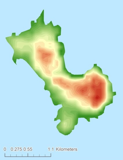
Topographic islandmap Hallands Väderö © OpenStreetMap-auteurs, CC-BY-SA. Map Hallands Väderö Hallands Väderö views: 244 Height map of Hallands Väderö |


