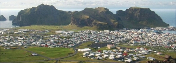
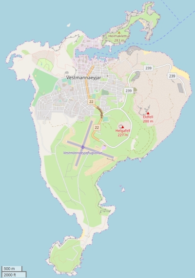
Description island HeimaeyThe inhabited small island of Heimaey is part of (the island group) and is located in the country of , Northern Europe. The distance to the mainland is about 970 km. The surface-area of the island is 13.3 km2 and is therefore 0.035 x times greater than the island of Isle of Wight. The island lies in the and the total coastal length is about 23.7 km and the dimensions of the island are approximately 4.8 km by 1.8 km (maximum width). The island is Northwest - South-southeast oriented. The highest point is 105 meter and is named Storholl. The coordinates (latitude, longitude) of the island (center) for GPS are 63.43 (63°25'53.1012), -20.27 (-20°16'1.9074).The population is 4500 and the population density is thus on 336.00 inhabitants per square kilometer (compared Isle of Wight 364 inhabitants / km²). The capital of the island is Heimaey (located in the North of the island). Other places on the island are: Heimaey (N). The island is located in the of the country . It is located in the administrative unit (local administrative level-name ), in the (local administrative level-name ). Direct neighboring islands of Heimaey are (distance from central part island to central part of the neighboring islands): 1) Bjarnarey Located 1.8 km NorthNorthEast of the island. 2) Iceland Located 9.4 km EastNorthEast of the island. 3) Surtsey Located 18 km SouthWest of the island. 4) Viðey Located 109 km SouthEast of the island. 5) Hjörsey Located 155.5 km SouthEast of the island. 6) Brokey Located 208.7 km EastSouthEast of the island. 7) Flatey Located 248.5 km EastSouthEast of the island. 8) Skáley Located 249 km EastSouthEast of the island. 9) Drangey Located 278.5 km East of the island. 10) Málmey Located 285.4 km East of the island. 11) Hrísey Located 294.9 km EastNorthEast of the island. 12) Vigur Located 313.6 km EastSouthEast of the island. 13) Æðey Located 315.1 km EastSouthEast of the island. 14) Flatey Located 321.5 km EastNorthEast of the island. 15) Papey Located 322.1 km NorthNorthEast of the island. 16) Grímsey Located 358.5 km EastNorthEast of the island. 17) Bjarnarey Located 384.3 km NorthEast of the island. 18) Mykines Located 657.4 km North of the island. 19) Vágar Located 665.9 km North of the island. 20) Streymoy Located 672.5 km North of the island. 21) Eysturoy Located 677.8 km North of the island. 22) Kalsoy Located 690.8 km North of the island. 23) Koltur Located 693.5 km North of the island. 24) Kunoy Located 696.5 km North of the island. 25) Hestur Located 698.5 km North of the island. The island is accessible by car (by means of ferry or bridge). The distance from Western-Europe (The Netherlands) is about 2600 km. There is a ferry connection for cars to the mainland. For pedestrians, there is a ferry connection to the mainland also. There are ferry connections with car to other (neighboring) island (s). There are also (seasonal) ferry connections for pedestrians (-cyclists) with other (neighboring) island(s). Far as is known, there are good cycling opportunities on the island. The source material on the island consists of rocky surface. The land use on the island of Heimaey consists of Sand - Rock 1.8 km2 (14%), nature 7.9 km2 (60%), To return to the overview page of this island click on the following link: Overview island Heimaey |
|


