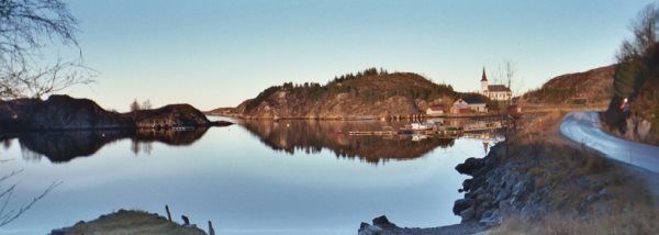
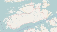
Description island HitraThe inhabited large island of Hitra is located in the country of Norway, Northern Europe. The distance to the mainland is about 4.1 km. The surface-area of the island is 543.7 km2 and is therefore 1.4 x times greater than the island of Isle of Wight. The island lies in the Norwegian Sea and the total coastal length is about 794.4 km and the dimensions of the island are approximately 40 km by 16 km (maximum width). The island is West-southwest - East-northeast oriented. The highest point is 345 meter and is named Mørkdalstuva . The coordinates (latitude, longitude) of the island (center) for GPS are 63.55 (63°32'46.4604), 8.76 (8°45'4.1562).The population is 4403 and the population density is thus on 8.10 inhabitants per square kilometer (compared Isle of Wight 364 inhabitants / km²). The capital of the island is Fillan (located in the Northeast of the island). Other places on the island are: Hestvika (O). The island is located in the Center of the country Norway. It is located in the administrative unit County Sør-Trøndelag (local administrative level-name Fylke), in the municipality Hitra (local administrative level-name Kommune). Direct neighboring islands of Hitra are (distance from central part island to central part of the neighboring islands): 1) Frøya Located 5.4 km East of the island. 2) Smøla Located 7.9 km SouthSouthWest of the island. 3) Linesøya Located 58 km NorthEast of the island. 4) Gossa Located 95.5 km SouthWest of the island. 5) Otrøya Located 105.3 km SouthWest of the island. 6) Sula Located 151.1 km SouthWest of the island. 7) Hareidlandet Located 164.3 km SouthWest of the island. 8) Gurskøya Located 181.4 km SouthWest of the island. 9) Leka Located 197.5 km NorthEast of the island. 10) Vågsøy Located 227.2 km SouthWest of the island. 11) Bremangerlandet Located 236.6 km SouthWest of the island. 12) Vega Located 254.8 km EastNorthEast of the island. 13) Frösön Located 265 km North of the island. 14) Alsta Located 294.9 km EastNorthEast of the island. 15) Dønna Located 306.4 km EastNorthEast of the island. 16) Ytre Sula Located 322.4 km SouthWest of the island. 17) Løkta Located 327.8 km EastNorthEast of the island. 18) Osterøy Located 334.7 km WestSouthWest of the island. 19) Tomma Located 336.6 km EastNorthEast of the island. 20) Fosnøyna Located 342.5 km WestSouthWest of the island. 21) Husøya Located 347.5 km EastNorthEast of the island. 22) Radøy Located 349.1 km WestSouthWest of the island. 23) Fedje Located 350.8 km SouthWest of the island. 24) Lurøya Located 356.6 km EastNorthEast of the island. 25) Holsnøy Located 358.5 km WestSouthWest of the island. The island is accessible by car (by means of ferry or bridge). The distance from Western-Europe (The Netherlands) is about 1680 km. Far as is known, there are good cycling opportunities on the island. The source material on the island consists of rocky surface. The land use on the island of Hitra consists of wood 119.2 km2 (22%), nature 222.1 km2 (41%), wet nature 169.5 km2 (31%), and agriculture 27.8 km2 (5%), To return to the overview page of this island click on the following link: Overview island Hitra |
|


