Description island HoyThe inhabited fairly large island of Hoy is part of (the island group) and is located in the country of , Western Europe. The distance to the mainland is about 12.4 km. The surface-area of the island is 135 km2 and is therefore 0.356 x times greater than the island of Isle of Wight. The island lies in the and the total coastal length is about 73.7 km and the dimensions of the island are approximately 19.5 km by 10.2 km (maximum width). The island is North-northwest - South-southeast oriented. The highest point is 476 meter and is named Ward Hill. The coordinates (latitude, longitude) of the island (center) for GPS are 58.86 (58°51'24.1056), -3.3 (-3°18'12.3084).The population is 419 and the population density is thus on 2.90 inhabitants per square kilometer (compared Isle of Wight 364 inhabitants / km²). The capital of the island is Lyness (located in the East-southeast of the island). Other places on the island are: Murra (N) Linksness (NNO) Lyness (OZO) Rinnigill (OZO) Saltness (Z) Melsetter (Z) Hurliness (Z) Brims (Z) Rackwick (W) . The island is located in the of the country . It is located in the administrative unit (local administrative level-name ), in the (local administrative level-name ). Direct neighboring islands of Hoy are (distance from central part island to central part of the neighboring islands): 1) South Walls Located 0.3 km NorthEast of the island. 2) Fara Located 0.8 km EastNorthEast of the island. 3) Graemsay Located 0.9 km North of the island. 4) Flotta Located 1.3 km NorthNorthEast of the island. 5) Mainland Orkney Located 2.6 km EastNorthEast of the island. 6) Inner Holm Located 4 km NorthEast of the island. 7) South Ronaldsay Located 7.5 km North of the island. 8) Island of Stroma Located 10.4 km NorthWest of the island. 9) Burray Located 10.8 km NorthNorthEast of the island. 10) Holm of Grimbister Located 15.4 km EastNorthEast of the island. 11) Shapinsay Located 23.4 km NorthEast of the island. 12) Gairsay Located 25.5 km NorthEast of the island. 13) Rousay Located 27.4 km EastNorthEast of the island. 14) Wyre Located 27.5 km NorthEast of the island. 15) Egilsay Located 32.1 km NorthEast of the island. 16) Stronsay Located 37.4 km NorthEast of the island. 17) Eday Located 37.9 km NorthEast of the island. 18) Auskerry Located 40.1 km NorthNorthEast of the island. 19) Westray Located 41.9 km EastNorthEast of the island. 20) Sanday Located 45.3 km NorthEast of the island. 21) Papa Westray Located 50.2 km EastNorthEast of the island. 22) North Ronaldsay Located 68.9 km NorthEast of the island. 23) Fair Isle Located 113.6 km NorthEast of the island. 24) Foula Located 149.7 km EastNorthEast of the island. 25) Mainland Shetland Located 153.2 km NorthEast of the island. The source material on the island consists of sand. The land use on the island of Hoy consists of Sand - Rock 0.9 km2 (1%), nature 101.2 km2 (75%), wet nature 16.6 km2 (12%), and agriculture 12.4 km2 (9%), To return to the overview page of this island click on the following link: Overview island Hoy |
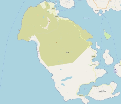
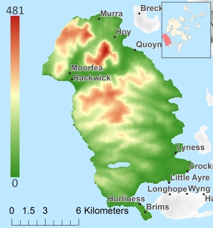
Topographic islandmap Hoy © OpenStreetMap-auteurs, CC-BY-SA. Map Hoy Hoy views: 219 Height map of Hoy |


