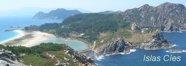
Description island Islas CiesThe inhabited small island of Islas Cies is part of (the island group) Cíes Islands and is located in the country of Spain, Southern Europe. The distance to the mainland is, quite close about 2.5 km. The surface-area of the island is 3 km2 and is therefore 0.008 x times greater than the island of Isle of Wight. The island lies in the Atlantic Ocean and the total coastal length is about 15.1 km and the dimensions of the island are approximately 4.5 km by 1.5 km (maximum width). The island is North - South oriented. The highest point is 197 meter and is named Alto das Cíes. The coordinates (latitude, longitude) of the island (center) for GPS are 42.23 (42°13'47.0604), -8.91 (-8°54'24.0264).The population is 0 and the population density is thus on 0.00 inhabitants per square kilometer (compared Isle of Wight 364 inhabitants / km²). The island is located in the Northwest of the country Spain. It is located in the administrative unit Autonomous Community Galicia (local administrative level-name Comunidad autónoma), in the Province Pontevedra (local administrative level-name Provincia). Direct neighboring islands of Islas Cies are (distance from central part island to central part of the neighboring islands): 1) Isla de San Martiño o del Sur Located 0.5 km WestNorthWest of the island. 2) Isla de Ons Located 11.7 km East of the island. 3) Isla de Salvora Located 24.8 km EastSouthEast of the island. 4) Isla de La Toja Located 26.2 km EastNorthEast of the island. 5) Isla de Arosa Located 30.5 km East of the island. 6) Isla Cortegada Located 41.6 km EastNorthEast of the island. 7) Sisarga Grande Located 122.7 km East of the island. 8) Santa Clara eiland Located 577 km NorthNorthEast of the island. 9) Pheasant Island Located 596.1 km NorthNorthEast of the island. 10) Île d'Yeu Located 716.6 km NorthEast of the island. 11) Île de Sein Located 717.3 km EastNorthEast of the island. 12) Belle-Île-en-Mer Located 718.5 km NorthEast of the island. 13) Île du Loc'h Located 718.8 km EastNorthEast of the island. 14) Île Chevallier Located 725.2 km EastNorthEast of the island. 15) Île d'Oléron Located 729 km NorthEast of the island. 16) Île de Ré Located 734.4 km NorthEast of the island. 17) Groix Located 734.8 km EastNorthEast of the island. 18) Île-d'Houat Located 738.3 km NorthEast of the island. 19) Île Hoëdic Located 738.6 km NorthEast of the island. 20) Île de Noirmoutier Located 742.8 km NorthEast of the island. 21) Île de Béniguet Located 747.4 km EastNorthEast of the island. 22) Ouessant Located 748.9 km EastNorthEast of the island. 23) Île-Molène Located 749.1 km EastNorthEast of the island. 24) Île-aux-Moines Located 758.9 km NorthEast of the island. 25) Perejil Island Located 761.2 km WestNorthWest of the island. For pedestrians, there is a ferry connection to the mainland also. Far as is known, there are good cycling opportunities on the island. The land use on the island of Islas Cies consists of nature 3.1 km2 (100%), To return to the overview page of this island click on the following link: Overview island Islas Cies |
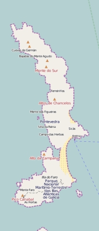
Topographic islandmap Islas Cies © OpenStreetMap-auteurs, CC-BY-SA. Map Islas Cies Islas Cies views: 1370 |


