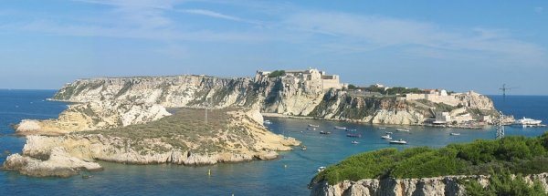
Description island Isola di San DominoThe inhabited small island of Isola di San Domino is part of (the island group) Isole Tremiti and is located in the country of Italy, Southern Europe. The distance to the mainland is about 21.5 km. The surface-area of the island is 2.1 km2 and is therefore 0.006 x times greater than the island of Isle of Wight. The island lies in the Adriatic Sea and the total coastal length is about 6.3 km and the dimensions of the island are approximately 2.5 km by 1.1 km (maximum width). The island is Southwest - Northeast oriented. The highest point is 116 meter and is named Colle dell'Eremita . The coordinates (latitude, longitude) of the island (center) for GPS are 42.11 (42°6'48.0312), 15.49 (15°29'1.3614).The population is 131 and the population density is thus on 66.00 inhabitants per square kilometer (compared Isle of Wight 364 inhabitants / km²). The capital of the island is San Domino (located in the Center of the island). The island is located in the East of the country Italy. It is located in the administrative unit Region Apulia (local administrative level-name regione), in the Province Foggia (local administrative level-name Provincia ). Direct neighboring islands of Isola di San Domino are (distance from central part island to central part of the neighboring islands): 1) Isola di San Nicola Located 0.3 km North of the island. 2) Isola di Capraia Located 1.3 km NorthEast of the island. 3) Palagruža Located 69.1 km NorthNorthEast of the island. 4) Biševo Located 100.8 km EastNorthEast of the island. 5) Vis Located 108.6 km EastNorthEast of the island. 6) Lastovo Located 128.3 km NorthEast of the island. 7) Korcula Located 129.6 km NorthEast of the island. 8) Proizd Located 132.1 km NorthEast of the island. 9) Sveti Klement Located 134.2 km EastNorthEast of the island. 10) Hvar Located 138.5 km EastNorthEast of the island. 11) Šolta Located 151.5 km EastNorthEast of the island. 12) Brac Located 152.1 km EastNorthEast of the island. 13) Drvenik Mali Located 153.3 km EastNorthEast of the island. 14) Drvenik Veli Located 153.4 km EastNorthEast of the island. 15) Ciovo Located 162.3 km EastNorthEast of the island. 16) Mljet Located 166.7 km NorthNorthEast of the island. 17) Žirje Located 167.7 km East of the island. 18) Kaprije Located 172.5 km East of the island. 19) Zlarin Located 173.1 km East of the island. 20) Prvic Located 178.5 km East of the island. 21) Kornat Located 178.6 km East of the island. 22) Murter Located 182.4 km East of the island. 23) Vrgada Located 191 km East of the island. 24) Procida Located 191.4 km SouthWest of the island. 25) Dugi Otok Located 194.6 km East of the island. For pedestrians, there is a ferry connection to the mainland also. There are also (seasonal) ferry connections for pedestrians (-cyclists) with other (neighboring) island(s). Far as is known, there are good cycling opportunities on the island. The land use on the island of Isola di San Domino consists of wood 0 km2 (6%), To return to the overview page of this island click on the following link: Overview island Isola di San Domino |
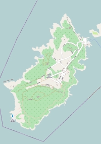
Topographic islandmap Isola di San Domino © OpenStreetMap-auteurs, CC-BY-SA. Map Isola di San Domino Isola di San Domino views: 801 |


