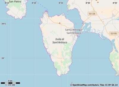
Description island Isola di Sant'AntiocoThe inhabited fairly large island of Isola di Sant'Antioco is part of (the island group) and is located in the country of , Southern Europe. The distance to the mainland is about 428.3 km. The surface-area of the island is 111 km2 and is therefore 0.292 x times greater than the island of Isle of Wight. The island lies in the and the total coastal length is about 77.8 km and the dimensions of the island are approximately 17.8 km by 9.7 km (maximum width). The island is West-northwest - East-southeast oriented. The coordinates (latitude, longitude) of the island (center) for GPS are 39.04 (39°0'15.1164), 8.41 (8°24'3.7386).The population is 11174 and the population density is thus on 127.00 inhabitants per square kilometer (compared Isle of Wight 364 inhabitants / km²). Other places on the island are: Calasetta. The island is located in the of the country . It is located in the administrative unit (local administrative level-name ), in the (local administrative level-name ). Direct neighboring islands of Isola di Sant'Antioco are (distance from central part island to central part of the neighboring islands): 1) Sardinia Located 0.1 km NorthNorthEast of the island. 2) Isola di San Pietro Located 3.7 km SouthSouthEast of the island. 3) Asinara Located 207.8 km East of the island. 4) Molara Located 224 km EastNorthEast of the island. 5) Tavolara Located 224.5 km EastNorthEast of the island. 6) Caprera Located 245.4 km EastNorthEast of the island. 7) La maddalena Located 247.1 km EastNorthEast of the island. 8) Corsica Located 258.7 km EastNorthEast of the island. 9) Île Cavallo Located 260.1 km EastNorthEast of the island. 10) Isola di Marettimo Located 330.9 km NorthNorthWest of the island. 11) Isola di Favignana Located 353.1 km NorthNorthWest of the island. 12) Isola di Levanzo Located 354.6 km NorthNorthWest of the island. 13) Menorca Located 356.7 km SouthSouthEast of the island. 14) Illa den Colom Located 362.5 km SouthSouthEast of the island. 15) Sicily Located 368.5 km NorthNorthWest of the island. 16) Pantelleria Located 387.7 km NorthWest of the island. 17) Montecristo Located 389.6 km EastNorthEast of the island. 18) Ustica Located 407.7 km North of the island. 19) Pianosa Located 408.5 km EastNorthEast of the island. 20) Del Giglio Located 413.8 km EastNorthEast of the island. 21) Giannutri Located 414.7 km EastNorthEast of the island. 22) Mallorca Located 425.2 km South of the island. 23) Palmarola Located 427.3 km NorthNorthEast of the island. 24) Elba Located 427.3 km EastNorthEast of the island. 25) Di Ponza Located 432.5 km NorthNorthEast of the island. The source material on the island consists of rocky surface. The land use on the island of Isola di Sant'Antioco consists of nature 58.6 km2 (53%), wet nature 0.9 km2 (1%), and agriculture 40.1 km2 (36%), Special is that the island also prevent vineyards (4.8 km2 - 4%). To return to the overview page of this island click on the following link: Overview island Isola di Sant'Antioco |
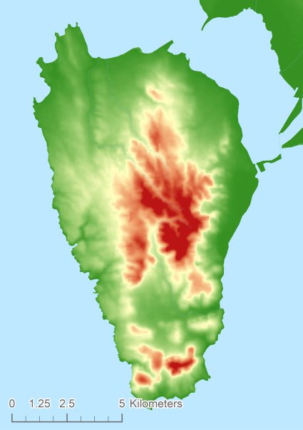
Topographic islandmap Isola di Sant'Antioco © OpenStreetMap-auteurs, CC-BY-SA. Map Isola di Sant'Antioco Isola di Sant'Antioco views: 258 Height map of Isola di Sant'Antioco |


