Description island Isola PolveseThe inhabited very small island of Isola Polvese is part of (the island group) and is located in the country of , Southern Europe. The island is situated in a lake. The distance to the mainland is, quite close about -100 km. The surface-area of the island is 0.790 km2 and is therefore 0.002 x times greater than the island of Isle of Wight. The island lies in the and the total coastal length is about 4.6 km and the dimensions of the island are approximately 1.7 km by 0.80 km (maximum width). The island is North-northwest - South-southeast oriented. The coordinates (latitude, longitude) of the island (center) for GPS are 43.12 (43°7'2.9280), 12.14 (12°8'17.0880).The population is 0 and the population density is thus on 0.00 inhabitants per square kilometer (compared Isle of Wight 364 inhabitants / km²). The island is located in the of the country . It is located in the administrative unit (local administrative level-name ), in the (local administrative level-name ). Direct neighboring islands of Isola Polvese are (distance from central part island to central part of the neighboring islands): 1) Isola Maggiore Located 6.3 km EastSouthEast of the island. 2) Isola Minore Located 6.6 km EastSouthEast of the island. 3) Isola Bisentina Located 61.6 km WestSouthWest of the island. 4) Isola Martana Located 64.2 km WestSouthWest of the island. 5) Giannutri Located 126.5 km SouthWest of the island. 6) Del Giglio Located 129.4 km SouthWest of the island. 7) Elba Located 140.8 km SouthSouthWest of the island. 8) Montecristo Located 171 km SouthSouthWest of the island. 9) Pianosa Located 175.9 km SouthSouthWest of the island. 10) Gorgona Located 183.5 km South of the island. 11) Capraia Located 186 km South of the island. 12) Isola del Tino Located 209.5 km SouthSouthEast of the island. 13) Isola del Tinetto Located 209.5 km SouthSouthEast of the island. 14) Palmaria Located 210.3 km SouthSouthEast of the island. 15) Corsica Located 217.7 km South of the island. 16) Susak Located 231.3 km NorthEast of the island. 17) Brijuni Located 234.9 km EastNorthEast of the island. 18) Unije Located 236.5 km NorthEast of the island. 19) Vele Srakane Located 237.5 km NorthEast of the island. 20) Premuda Located 239.1 km NorthEast of the island. 21) Losinj Located 239.9 km NorthEast of the island. 22) Ilovik Located 242.3 km NorthEast of the island. 23) Dugi Otok Located 244.3 km NorthNorthEast of the island. 24) Ist Located 244.9 km NorthNorthEast of the island. 25) Lido Located 246.7 km East of the island. The source material on the island consists of rocky surface. The land use on the island of Isola Polvese consists of To return to the overview page of this island click on the following link: Overview island Isola Polvese |
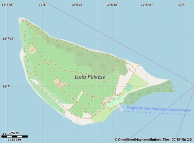
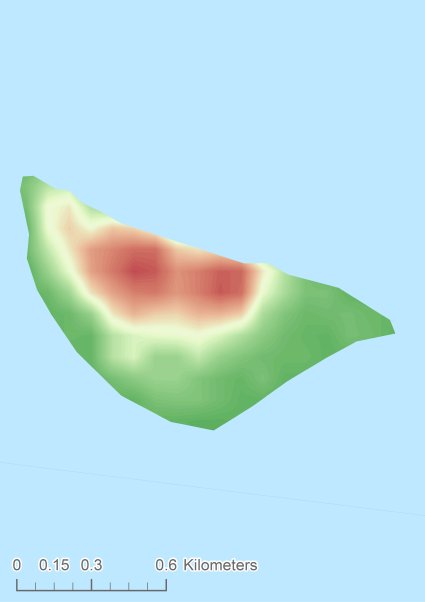
Topographic islandmap Isola Polvese © OpenStreetMap-auteurs, CC-BY-SA. Map Isola Polvese Isola Polvese views: 206 Height map of Isola Polvese |


