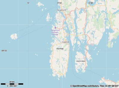
Description island KarmøyThe inhabited fairly large island of Karmøy is part of (the island group) and is located in the country of , Northern Europe. The distance to the mainland is, quite close about 0.2 km. The surface-area of the island is 170 km2 and is therefore 0.448 x times greater than the island of Isle of Wight. The island lies in the and the total coastal length is about 296 km and the dimensions of the island are approximately 30.3 km by 9 km (maximum width). The island is West - East oriented. The coordinates (latitude, longitude) of the island (center) for GPS are 59.26 (59°15'23.7852), 5.25 (5°15'15.8616).The population is 0 and the population density is thus on 0.00 inhabitants per square kilometer (compared Isle of Wight 364 inhabitants / km²). Other places on the island are: Visnes. The island is located in the of the country . It is located in the administrative unit (local administrative level-name ), in the (local administrative level-name ). Direct neighboring islands of Karmøy are (distance from central part island to central part of the neighboring islands): 1) Vestre Bokn Located 2.8 km North of the island. 2) Rennesøya Located 15.2 km NorthNorthWest of the island. 3) Finnøya Located 26 km North of the island. 4) Moster Located 29.3 km East of the island. 5) Ombo Located 33.7 km North of the island. 6) Bømlo Located 35.1 km East of the island. 7) Stord Located 38.8 km EastNorthEast of the island. 8) Borgundøya Located 41.1 km NorthEast of the island. 9) Halsnøya Located 44.8 km NorthEast of the island. 10) Tysnesøya Located 55.8 km EastNorthEast of the island. 11) Selbjørn Located 62.1 km East of the island. 12) Stolmen Located 64 km East of the island. 13) Huftarøy Located 64.5 km East of the island. 14) Hundvåko Located 75.7 km East of the island. 15) Stora Kalsøy Located 78.7 km East of the island. 16) Eigerøya Located 83.7 km WestNorthWest of the island. 17) Toftøyna Located 84 km East of the island. 18) Sotra Located 85.1 km East of the island. 19) Askøy Located 108.8 km East of the island. 20) Osterøy Located 114.3 km East of the island. 21) Holsnøy Located 121.7 km East of the island. 22) Hidra Located 122.6 km NorthWest of the island. 23) Radøy Located 128.3 km East of the island. 24) Alvøyna Located 132.1 km East of the island. 25) Fosnøyna Located 147.6 km East of the island. The source material on the island consists of rocky surface. The land use on the island of Karmøy consists of wood 7.9 km2 (5%), nature 57.6 km2 (34%), wet nature 4.2 km2 (3%), and agriculture 78.2 km2 (46%), To return to the overview page of this island click on the following link: Overview island Karmøy |
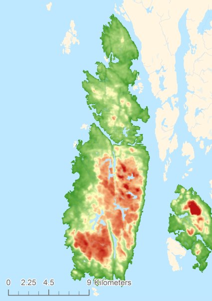
Topographic islandmap Karmøy © OpenStreetMap-auteurs, CC-BY-SA. Map Karmøy Karmøy views: 224 Height map of Karmøy |


