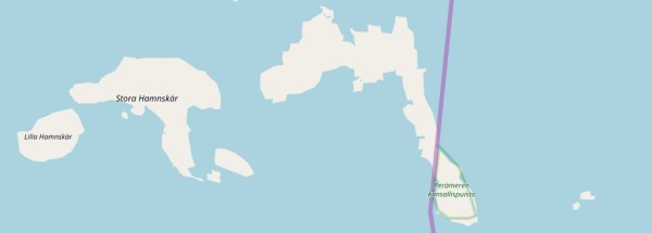
Description island KatajaThe inhabited very small island of Kataja is part of (the island group) and is located in the country of , Northern Europe. The distance to the mainland is about 3.9 km. The surface-area of the island is 1 km2 and is therefore 0.003 x times greater than the island of Isle of Wight. The island lies in the and the total coastal length is about 8.3 km and the dimensions of the island are approximately 2.4 km by 1.5 km (maximum width). The island is North-northwest - South-southeast oriented. The coordinates (latitude, longitude) of the island (center) for GPS are 65.71 (65°42'34.6572), 24.15 (24°8'46.4748).The population is 0 and the population density is thus on 0.00 inhabitants per square kilometer (compared Isle of Wight 364 inhabitants / km²). The island is located in the of the country . It is located in the administrative unit (local administrative level-name ), in the (local administrative level-name ). Direct neighboring islands of Kataja are (distance from central part island to central part of the neighboring islands): 1) Seskarö Located 15.1 km SouthSouthEast of the island. 2) Rånön Located 52 km South of the island. 3) Hailuoto Located 71.9 km WestNorthWest of the island. 4) Holmön Located 260.9 km SouthWest of the island. 5) Björkö Located 291.1 km WestSouthWest of the island. 6) Replot Located 299.6 km WestSouthWest of the island. 7) Norra Ulvön Located 393.1 km SouthWest of the island. 8) Södra Ulvön Located 398.8 km SouthWest of the island. 9) Hemsön Located 438.6 km SouthWest of the island. 10) Tjeldøya Located 450.7 km SouthEast of the island. 11) Andørja Located 453 km SouthEast of the island. 12) Rolla Located 453.5 km SouthEast of the island. 13) Hinnøya Located 458.1 km SouthEast of the island. 14) Engeløya Located 459 km SouthEast of the island. 15) Lundøya Located 461.6 km SouthEast of the island. 16) Dyrøya Located 465.6 km SouthEast of the island. 17) Sandhornøya Located 465.9 km SouthSouthEast of the island. 18) Senja Located 467.5 km EastSouthEast of the island. 19) Landegode Located 470.5 km SouthSouthEast of the island. 20) Uløya Located 478.4 km EastSouthEast of the island. 21) Grytøya Located 479 km SouthEast of the island. 22) Fugløya Located 482.2 km SouthSouthEast of the island. 23) Alnön Located 485.2 km SouthWest of the island. 24) Kvaløya Located 485.8 km EastSouthEast of the island. 25) Meløya Located 489.6 km SouthSouthEast of the island. The source material on the island consists of rocky surface. The land use on the island of Kataja consists of wood 0.9 km2 (90%), To return to the overview page of this island click on the following link: Overview island Kataja |
|


