Description island КолгуевThe inhabited very large island of Колгуев is part of (the island group) and is located in the country of , Eastern Europe. The distance to the mainland is about 59.5 km. The surface-area of the island is 5069.3 km2 and is therefore 13.3 x times greater than the island of Isle of Wight. The island lies in the and the total coastal length is about 580.2 km and the dimensions of the island are approximately 91.7 km by 80.9 km (maximum width). The island has No maindirection-circular. The coordinates (latitude, longitude) of the island (center) for GPS are 69.11 (69°6'51.3720), 49.11 (49°6'32.9760).The population is 436 and the population density is thus on 0.12 inhabitants per square kilometer (compared Isle of Wight 364 inhabitants / km²). The capital of the island is Bugrino (located in the South-southeast of the island). Other places on the island are: Bugrino (Russisch: Бугрино) (Z), Severnyy. The island is located in the of the country . It is located in the administrative unit (local administrative level-name ), in the (local administrative level-name ). Direct neighboring islands of Kolgoejev are (distance from central part island to central part of the neighboring islands): 1) Novaya Zemlya Located 212.9 km NorthEast of the island. 2) Morzhovets Located 327.8 km SouthWest of the island. 3) Vaygach Located 335.5 km NorthNorthEast of the island. 4) Solovetsky Islands Located 658.9 km SouthSouthWest of the island. 5) Kiy Located 703.6 km SouthWest of the island. 6) Magerøya Located 854.9 km SouthSouthEast of the island. 7) Reinøya Located 888.5 km SouthSouthEast of the island. 8) Måsøya Located 897.3 km SouthSouthEast of the island. 9) Hjelmsøya Located 904.8 km SouthSouthEast of the island. 10) Havøya Located 909.7 km SouthSouthEast of the island. 11) Reinøya Located 924.4 km SouthSouthEast of the island. 12) Rolvsøya Located 927.3 km SouthSouthEast of the island. 13) Ingøya Located 930.4 km SouthSouthEast of the island. 14) Kvaløya Located 931.7 km SouthSouthEast of the island. 15) Seiland Located 950.6 km SouthSouthEast of the island. 16) Sørøya Located 954 km SouthSouthEast of the island. 17) Kizhi Located 954.8 km SouthWest of the island. 18) Stjernøya Located 976.4 km SouthSouthEast of the island. 19) Silda Located 1020.4 km SouthSouthEast of the island. 20) Arnøya Located 1059.6 km SouthSouthEast of the island. 21) Uløya Located 1067 km SouthSouthEast of the island. 22) Spitsbergen Located 1084.6 km SouthEast of the island. 23) Kataja Located 1086 km South of the island. 24) Vanna Located 1086.7 km SouthSouthEast of the island. 25) Hailuoto Located 1088.6 km SouthSouthWest of the island. The source material on the island consists of rocky surface. The land use on the island of Kolgoejev consists of To return to the overview page of this island click on the following link: Overview island Колгуев |
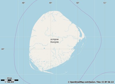
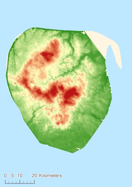
Topographic islandmap Колгуев © OpenStreetMap-auteurs, CC-BY-SA. Map Kolgoejev Колгуев views: 185 Height map of Колгуев |


