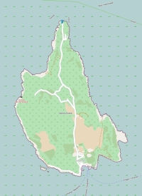
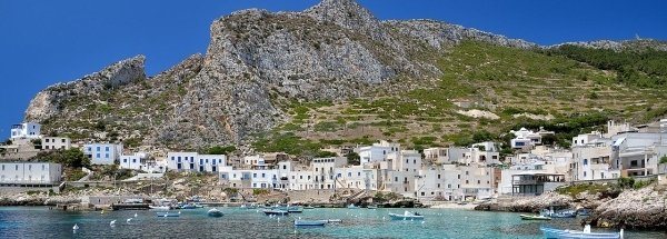
Description island Isola di LevanzoThe inhabited small island of Isola di Levanzo is part of (the island group) Aegadian Islands and is located in the country of Italy, Southern Europe. The distance to the mainland is about 151 km. The nearest (main) land is Tunesia and is not the country to which the island belongs. The surface-area of the island is 5.8 km2 and is therefore 0.015 x times greater than the island of Isle of Wight. The island lies in the Tyrrhenian Sea and the total coastal length is about 14.2 km and the dimensions of the island are approximately 3.9 km by 2 km (maximum width). The island is North-northwest - South-southeast oriented. The highest point is 278 meter and is named Pizzo Monaco. The coordinates (latitude, longitude) of the island (center) for GPS are 38 (37°59'57.7788), 12.34 (12°20'6.1368).The population is 208 and the population density is thus on 35.90 inhabitants per square kilometer (compared Isle of Wight 364 inhabitants / km²). The capital of the island is Levanzo (located in the South of the island). The island is located in the South of the country Italy. It is located in the administrative unit Autonomous region Sicily (local administrative level-name regione), in the Province Trapani (local administrative level-name Provincia ). Direct neighboring islands of Levanzo are (distance from central part island to central part of the neighboring islands): 1) Isola di Favignana Located 3.9 km WestSouthWest of the island. 2) Sicily Located 12.4 km North of the island. 3) Isola di Marettimo Located 20.9 km SouthSouthWest of the island. 4) Ustica Located 103.4 km NorthEast of the island. 5) Pantelleria Located 131.5 km WestSouthWest of the island. 6) Alicudi Located 184.1 km NorthNorthEast of the island. 7) Filicudi Located 201.9 km NorthNorthEast of the island. 8) Salina Located 222.9 km NorthNorthEast of the island. 9) Lipari Located 229.3 km NorthNorthEast of the island. 10) Vulcano Located 230.8 km NorthNorthEast of the island. 11) Linosa Located 238.6 km WestNorthWest of the island. 12) Panarea Located 246.4 km NorthNorthEast of the island. 13) Stromboli Located 262.9 km NorthNorthEast of the island. 14) Gozo Located 267.8 km NorthWest of the island. 15) Lampione Located 269.9 km West of the island. 16) Sardinia Located 271.2 km SouthSouthEast of the island. 17) Lampedusa Located 273 km West of the island. 18) Comino Located 280.3 km NorthWest of the island. 19) Malta Located 283.1 km NorthWest of the island. 20) Islands of St. Paul Located 289.2 km NorthWest of the island. 21) Ventotene Located 320.5 km EastNorthEast of the island. 22) Di Ponza Located 321.6 km East of the island. 23) Santo Stefano Located 321.9 km EastNorthEast of the island. 24) Capri Located 322.2 km EastNorthEast of the island. 25) Ischia Located 325.4 km EastNorthEast of the island. For pedestrians, there is a ferry connection to the mainland also. There are also (seasonal) ferry connections for pedestrians (-cyclists) with other (neighboring) island(s). Far as is known, there are good cycling opportunities on the island. The land use on the island of Levanzo consists of nature 4.1 km2 (71%), and agriculture 1.3 km2 (23%), Special is that the island also prevent vineyards (0.3 km2 - 6%). To return to the overview page of this island click on the following link: Overview island Isola di Levanzo |
Topographic islandmap Isola di Levanzo © OpenStreetMap-auteurs, CC-BY-SA. Map Levanzo Isola di Levanzo views: 819 |


