Description island LosinjThe inhabited fairly large island of Losinj is part of (the island group) Kvarner islands and is located in the country of Croatia, Southern Europe. The distance to the mainland is about 28.5 km. The surface-area of the island is 74 km2 and is therefore 0.195 x times greater than the island of Isle of Wight. The island lies in the Adriatic Sea and the total coastal length is about 96.3 km and the dimensions of the island are approximately 33 km by 5 km (maximum width). The island is North-northwest - South-southeast oriented. The highest point is 589 meter and is named Televrina. The coordinates (latitude, longitude) of the island (center) for GPS are 44.6 (44°3'34.7364), 14.41 (14°24'53.5608).The population is 7771 and the population density is thus on 104.51 inhabitants per square kilometer (compared Isle of Wight 364 inhabitants / km²). The capital of the island is Mali Lošinj (located in the Center of the island). Other places on the island are: Nerezine (NO). The island is located in the West-southwest of the country Croatia. It is located in the administrative unit Primorje-Gorski Kotar County (local administrative level-name Zupanija Primorje), in the municipality Mali Losinj (local administrative level-name Grad). Direct neighboring islands of Losinj are (distance from central part island to central part of the neighboring islands): 1) Cres Located 0.2 km NorthEast of the island. 2) Ilovik Located 1.6 km WestNorthWest of the island. 3) Vele Srakane Located 3.5 km South of the island. 4) Unije Located 4.4 km South of the island. 5) Susak Located 6.6 km WestSouthWest of the island. 6) Silba Located 12.9 km NorthWest of the island. 7) Premuda Located 14.2 km WestNorthWest of the island. 8) Olib Located 19.2 km NorthNorthWest of the island. 9) Rab Located 23.6 km NorthNorthEast of the island. 10) Pag Located 24.6 km NorthEast of the island. 11) Ist Located 26.9 km NorthWest of the island. 12) Molat Located 31.6 km NorthWest of the island. 13) Krk Located 36.3 km NorthEast of the island. 14) Vir Located 42 km NorthNorthWest of the island. 15) Dugi Otok Located 42.1 km NorthWest of the island. 16) Zverinac Located 44.1 km NorthWest of the island. 17) Sestrunj Located 44.8 km NorthWest of the island. 18) Brijuni Located 49.1 km SouthSouthEast of the island. 19) Rivanj Located 51.9 km NorthWest of the island. 20) Ugljan Located 55.2 km NorthWest of the island. 21) Iž Located 61.3 km NorthWest of the island. 22) Rava Located 63.7 km NorthWest of the island. 23) Pašman Located 77.2 km NorthWest of the island. 24) Sveti Nikola Located 82 km SouthEast of the island. 25) Kornat Located 86.7 km NorthWest of the island. There is a ferry connection for cars to the mainland. For pedestrians, there is a ferry connection to the mainland also. Far as is known, there are good cycling opportunities on the island. The land use on the island of Losinj consists of wood 37.7 km2 (51%), nature 18.3 km2 (25%), and agriculture 7.6 km2 (10%), To return to the overview page of this island click on the following link: Overview island Losinj |
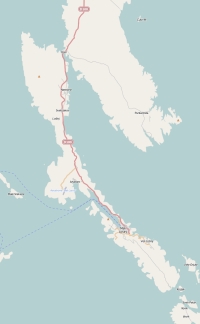
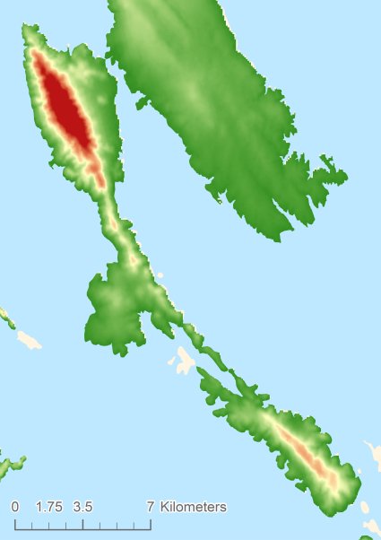
Topographic islandmap Losinj © OpenStreetMap-auteurs, CC-BY-SA. Map Losinj Losinj views: 839 Height map of Losinj |


