Description island LyøThe inhabited small island of Lyø is part of (the island group) and is located in the country of , Northern Europe. The distance to the mainland is about 25.5 km. The surface-area of the island is 6.1 km2 and is therefore 0.016 x times greater than the island of Isle of Wight. The island lies in the and the total coastal length is about 17.1 km and the dimensions of the island are approximately 3.6 km by 2.9 km (maximum width). The island is Northwest - Southeast oriented. The coordinates (latitude, longitude) of the island (center) for GPS are 55.04 (55°2'2.8482), 10.15 (10°9'7.2036).The population is 140 and the population density is thus on 23.33 inhabitants per square kilometer (compared Isle of Wight 364 inhabitants / km²). The capital of the island is Lyø By (located in the Center of the island). Other places on the island are: . The island is located in the of the country . It is located in the administrative unit (local administrative level-name ), in the (local administrative level-name ). Direct neighboring islands of Lyø are (distance from central part island to central part of the neighboring islands): 1) Funen Located 1.9 km EastNorthEast of the island. 2) Ærø Located 7.5 km WestNorthWest of the island. 3) Als Located 10.5 km SouthSouthWest of the island. 4) Tåsinge Located 21.7 km North of the island. 5) Bågø Located 33.1 km SouthEast of the island. 6) Langeland Located 34.9 km NorthNorthWest of the island. 7) Lolland Located 54.9 km NorthNorthWest of the island. 8) Omø Located 62.2 km NorthNorthEast of the island. 9) Agersø Located 65.7 km NorthNorthEast of the island. 10) Seeland Located 67.2 km NorthNorthEast of the island. 11) Fejø Located 75.3 km North of the island. 12) Endelave Located 75.9 km East of the island. 13) Fehmarn Located 80 km NorthWest of the island. 14) Samsø Located 82.5 km EastNorthEast of the island. 15) Femø Located 84.6 km North of the island. 16) Rømø Located 93.8 km South of the island. 17) Falster Located 98.4 km North of the island. 18) Mandø Located 100.3 km SouthSouthEast of the island. 19) Föhr Located 104.3 km SouthSouthWest of the island. 20) Pellworm Located 106 km SouthSouthWest of the island. 21) Sylt Located 106.1 km South of the island. 22) Fanø Located 109.6 km SouthSouthEast of the island. 23) Sejerø Located 110 km NorthEast of the island. 24) Bogø Located 115.7 km North of the island. 25) Amrum Located 119.1 km SouthSouthWest of the island. The source material on the island consists of sand. The land use on the island of Lyø consists of nature 0.3 km2 (4%), and agriculture 5.5 km2 (90%), To return to the overview page of this island click on the following link: Overview island Lyø |
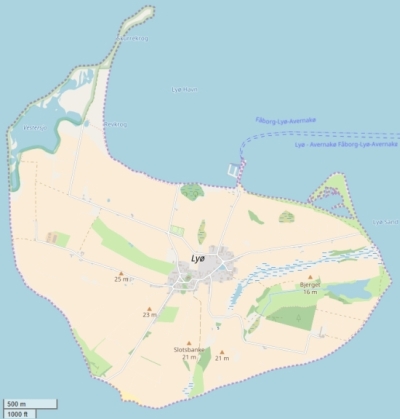
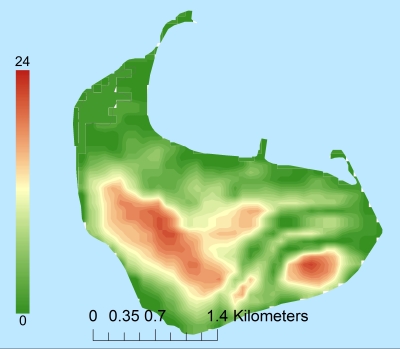
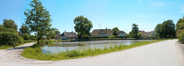
Topographic islandmap Lyø © OpenStreetMap-auteurs, CC-BY-SA. Map Lyø Lyø views: 251 Height map of Lyø |


