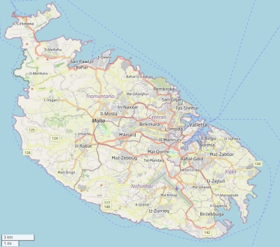
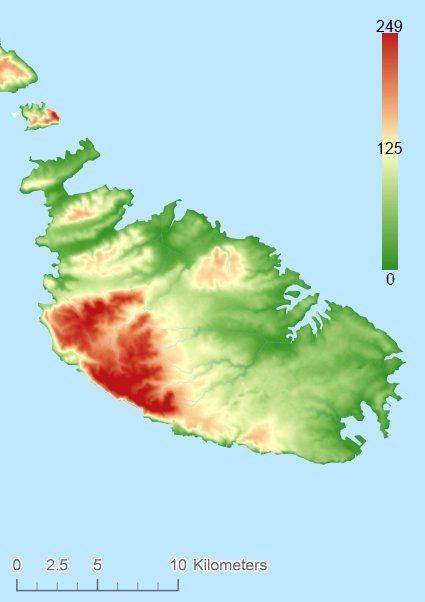
Description island MaltaThe inhabited large island of Malta is part of (the island group) Malta - country and is located in the country of Malta, Southern Europe. The distance to the mainland is about 245.8 km. The nearest (main) land is Italy and is not the country to which the island belongs. The surface-area of the island is 246.7 km2 and is therefore 0.65 x times greater than the island of Isle of Wight. The island lies in the Mediterranean Sea and the total coastal length is about 155.1 km and the dimensions of the island are approximately 28.4 km by 12.7 km (maximum width). The island is Northwest - Southeast oriented. The highest point is 249 meter and is named Dingli Cliffs. The coordinates (latitude, longitude) of the island (center) for GPS are 35.89 (35°53'17.6964), 14.44 (14°26'24.4464).The population is 388232 and the population density is thus on 1578.00 inhabitants per square kilometer (compared Isle of Wight 364 inhabitants / km²). The capital of the island is Valletta (located in the Northeast of the island). Other places on the island are: Birkirkara (M), Qormi (M). The island is located in the Center of the country Malta. Direct neighboring islands of Malta are (distance from central part island to central part of the neighboring islands): 1) Islands of St. Paul Located 0.1 km NorthEast of the island. 2) Comino Located 1.6 km East of the island. 3) Gozo Located 4 km East of the island. 4) Sicily Located 85.2 km EastNorthEast of the island. 5) Linosa Located 130.2 km South of the island. 6) Lampedusa Located 159.1 km SouthSouthWest of the island. 7) Lampione Located 185.5 km SouthSouthWest of the island. 8) Pantelleria Located 221.2 km SouthSouthEast of the island. 9) Vulcano Located 268.5 km East of the island. 10) Isola di Favignana Located 275.3 km SouthEast of the island. 11) Lipari Located 275.8 km East of the island. 12) Alicudi Located 281 km East of the island. 13) Isola di Levanzo Located 283.1 km SouthEast of the island. 14) Filicudi Located 284.2 km East of the island. 15) Salina Located 284.8 km East of the island. 16) Isola di Marettimo Located 294.7 km SouthEast of the island. 17) Panarea Located 297.8 km East of the island. 18) Ustica Located 316.7 km EastSouthEast of the island. 19) Stromboli Located 316.8 km EastNorthEast of the island. 20) Capri Located 503.9 km East of the island. 21) Ischia Located 522.6 km East of the island. 22) Procida Located 527.1 km East of the island. 23) Santo Stefano Located 537.5 km East of the island. 24) Ventotene Located 537.8 km East of the island. 25) Sardinia Located 546.7 km SouthEast of the island. Note: The information described below is partly subject to change. The island is directly accessible from Western Europe by plane. An international airport is present on the island. There is a ferry connection for cars to the mainland. For pedestrians, there is a ferry connection to the mainland also. Far as is known, there are good cycling opportunities on the island. The source material on the island consists of rocky surface. The land use on the island of Malta consists of wood 1.8 km2 (1%), nature 33.3 km2 (14%), and agriculture 118.4 km2 (48%), To return to the overview page of this island click on the following link: Overview island Malta |
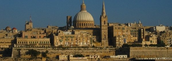
Topographic islandmap Malta © OpenStreetMap-auteurs, CC-BY-SA. Map Malta Malta views: 1157 Height map of Malta |


