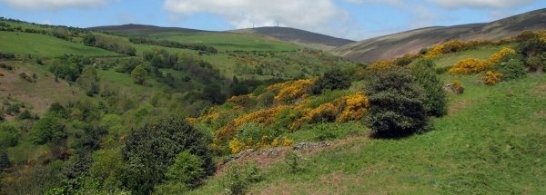
Description island ManThe inhabited large island of Man (local name Isle of Man) is located in the country of Guernsey-Jersey-Man, Western Europe. The distance to the mainland is about 29 km. The nearest (main) land is Great Britain and is not the country to which the island belongs. The surface-area of the island is 580.4 km2 and is therefore 1.5 x times greater than the island of Isle of Wight. The island lies in the Irish Sea and the total coastal length is about 126 km and the dimensions of the island are approximately 48 km by 18 km (maximum width). The island is South-southwest - North-northeast oriented. The highest point is 621 meter and is named Snaefell. The coordinates (latitude, longitude) of the island (center) for GPS are 54.2 (54°13'00.0000), -4.6 (-4°36'0.0000).The population is 84655 and the population density is thus on 140.00 inhabitants per square kilometer (compared Isle of Wight 364 inhabitants / km²). The capital of the island is Douglas (located in the West-southwest of the island). Other places on the island are: Peel (W), Ramsey (NO). The island is located in the West of the country Guernsey-Jersey-Man. Direct neighboring islands of Man are (distance from central part island to central part of the neighboring islands): 1) Anglesey Located 70.8 km West of the island. 2) Holy Island Located 80.8 km West of the island. 3) Lambay Located 102.5 km SouthWest of the island. 4) Arran Located 123.4 km EastSouthEast of the island. 5) Holy Island Located 129.9 km EastSouthEast of the island. 6) Bardsey Island Located 143.6 km West of the island. 7) Rathlin Island Located 145.6 km SouthEast of the island. 8) Isle of Bute Located 151.2 km EastSouthEast of the island. 9) Great Cumbrae Island Located 151.8 km EastSouthEast of the island. 10) Gigha Located 162 km EastSouthEast of the island. 11) Islay Located 172.9 km SouthEast of the island. 12) Jura Located 182.6 km EastSouthEast of the island. 13) Scarba Located 211.5 km EastSouthEast of the island. 14) Oronsay Located 211.8 km EastSouthEast of the island. 15) Holy Island Located 212.9 km NorthEast of the island. 16) Luing Located 212.9 km EastSouthEast of the island. 17) Colonsay Located 213 km EastSouthEast of the island. 18) Inner Farne Located 218 km NorthEast of the island. 19) Staple Island Located 220.5 km NorthEast of the island. 20) Seil Located 220.7 km EastSouthEast of the island. 21) Isle of May Located 227.1 km EastNorthEast of the island. 22) Mull Located 230.1 km EastSouthEast of the island. 23) Kerrera Located 230.3 km EastSouthEast of the island. 24) Lismore Located 240.4 km EastSouthEast of the island. 25) Ramsey Island Located 245.6 km West of the island. Note: The information described below is partly subject to change. The island is directly accessible from Western Europe by plane. An international airport is present on the island. The island is accessible by car (by means of ferry or bridge). The distance from Western-Europe (The Netherlands) is about 887 km. There is a ferry connection for cars to the mainland. For pedestrians, there is a ferry connection to the mainland also. Far as is known, there are good cycling opportunities on the island. The source material on the island consists of rocky surface. The land use on the island of Man consists of Sand - Rock 6.2 km2 (1%), wood 34.5 km2 (6%), nature 129.3 km2 (22%), and agriculture 351.2 km2 (61%), To return to the overview page of this island click on the following link: Overview island Man |
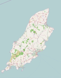
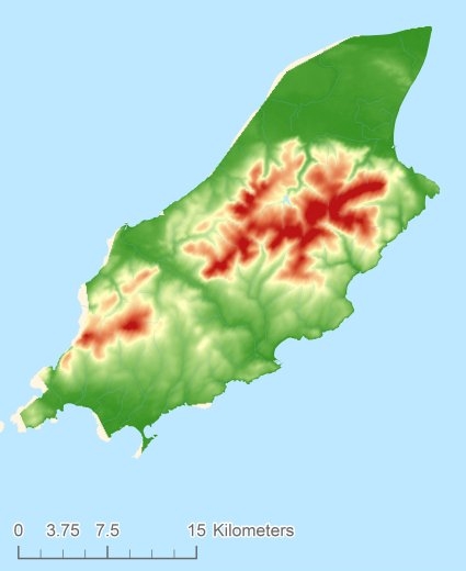
Topographic islandmap Man © OpenStreetMap-auteurs, CC-BY-SA. Map Man Man views: 853 Height map of Man |


