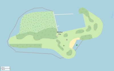
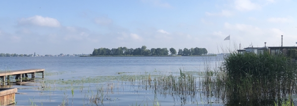
Description island Markus PosThe uninhabited very small island of Markus Pos is part of (the island group) islands - Loosdrechtse Plassen and is located in the country of The Netherlands, Western Europe. The island is not natural and artificial man-made The distance to the mainland is, quite close about 0.5 km. The surface-area of the island is 0.050 km2 and is therefore 0 x times greater than the island of Isle of Wight. The island lies in the Loosdrechtse Plassen and the total coastal length is about 1.1 km and the length of the island is about km. The coordinates (latitude, longitude) of the island (center) for GPS are 52.19 (52°11'34.9512), 5.08 (5°4'36.1632).It is located in the administrative unit Province North Holland (local administrative level-name Provincie), in the Municipality Wijdemeren (local administrative level-name Gemeente). Direct neighboring islands of Markus Pos are (distance from central part island to central part of the neighboring islands): 1) Robinson Crusoë Located 0.3 km EastSouthEast of the island. 2) Geitekaai Located 0.9 km SouthWest of the island. 3) Meent Located 2 km WestSouthWest of the island. 4) Pampus Located 18.9 km East of the island. 5) Rietplaat Located 53.2 km WestSouthWest of the island. 6) Buisjes Located 53.6 km WestSouthWest of the island. 7) Hennipje Located 54.1 km WestSouthWest of the island. 8) Vischplaat Located 54.7 km WestSouthWest of the island. 9) Boerenplaat Located 56.7 km WestSouthWest of the island. 10) Middenplaat Located 68.3 km SouthSouthWest of the island. 11) Tiengemeten Located 70.8 km SouthWest of the island. 12) Slijkplaat Located 76.4 km SouthWest of the island. 13) Noordplaat Located 83.3 km SouthWest of the island. 14) Markenje Located 87.6 km SouthSouthWest of the island. 15) Kabeljauwplaat Located 87.8 km SouthWest of the island. 16) Veermansplaat Located 88.4 km SouthSouthWest of the island. 17) Hompelvoet Located 89.2 km SouthSouthWest of the island. 18) Noorderhaaks - De razende bol Located 89.6 km EastSouthEast of the island. 19) Eiland in Krabbenkreek Located 90.2 km SouthWest of the island. 20) Stampersplaat Zuid Located 91 km SouthSouthWest of the island. 21) Stampersplaat Located 91.1 km SouthSouthWest of the island. 22) Texel Located 91.2 km EastSouthEast of the island. 23) Dwars in den Weg Located 93.3 km SouthSouthWest of the island. 24) Ossehoek Located 94.8 km SouthSouthWest of the island. 25) Prinsesseplaat Located 95.7 km SouthWest of the island. To return to the overview page of this island click on the following link: Overview island Markus Pos |
Topographic islandmap Markus Pos © OpenStreetMap-auteurs, CC-BY-SA. Map Markus Pos Markus Pos views: 1058 |


