Description island MenorcaThe inhabited large island of Menorca (local name Isla de Menorca) is part of (the island group) Balearic Islands and is located in the country of Spain, Southern Europe. The distance to the mainland is about 198.1 km. The surface-area of the island is 694.1 km2 and is therefore 1.8 x times greater than the island of Isle of Wight. The island lies in the Balearic Sea and the total coastal length is about 280.3 km and the dimensions of the island are approximately 47 km by 19 km (maximum width). The island is West-northwest - East-southeast oriented. The highest point is 358 meter and is named Monte Toro. The coordinates (latitude, longitude) of the island (center) for GPS are 39.96 (39°57'36.6048), 4.07 (4°4'2.379).The population is 92434 and the population density is thus on 133.12 inhabitants per square kilometer (compared Isle of Wight 364 inhabitants / km²). The capital of the island is Mahón (located in the East-southeast of the island). Other places on the island are: Ciutadella (W). The island is located in the East of the country Spain. It is located in the administrative unit Autonomous Community Balearic Islands (local administrative level-name Comunidad autónoma), in the Province Balearic Islands (local administrative level-name Provincia). Direct neighboring islands of Menorca are (distance from central part island to central part of the neighboring islands): 1) Illa den Colom Located 0.3 km EastNorthEast of the island. 2) Mallorca Located 36.5 km SouthSouthWest of the island. 3) Conejera Located 109.5 km SouthWest of the island. 4) Cabrera Located 111.8 km SouthWest of the island. 5) Dragonera Located 132.1 km SouthSouthWest of the island. 6) Tagomago Located 211.3 km SouthSouthWest of the island. 7) Ibiza Located 212 km SouthSouthWest of the island. 8) Medes Islands Located 226.9 km EastSouthEast of the island. 9) Espardell Located 237.1 km SouthSouthWest of the island. 10) Formentera Located 237.5 km SouthWest of the island. 11) Espalmador Located 241.5 km SouthSouthWest of the island. 12) Conejera Located 246.9 km SouthSouthWest of the island. 13) Vedrà Located 254.2 km SouthSouthWest of the island. 14) Islas Columbretes Located 265.4 km South of the island. 15) Sardinia Located 334.5 km NorthNorthEast of the island. 16) Isola di San Pietro Located 344.3 km NorthNorthWest of the island. 17) Asinara Located 351.7 km NorthNorthEast of the island. 18) Isola di Sant'Antioco Located 356.7 km NorthNorthWest of the island. 19) Île des Embiez Located 359.7 km EastNorthEast of the island. 20) Bendor eiland Located 364.4 km EastNorthEast of the island. 21) Île de Porquerolles Located 365.8 km EastNorthEast of the island. 22) Île Pomègues Located 366 km EastNorthEast of the island. 23) Île Ratonneau Located 368.1 km EastNorthEast of the island. 24) Île de Port Cros Located 374.1 km EastNorthEast of the island. 25) Benidorm Island Located 375.8 km SouthSouthWest of the island. Note: The information described below is partly subject to change. The island is directly accessible from Western Europe by plane. An international airport is present on the island. The island is accessible by car (by means of ferry or bridge). The distance from Western-Europe (The Netherlands) is about 1754 km. There is a ferry connection for cars to the mainland. For pedestrians, there is a ferry connection to the mainland also. Far as is known, there are good cycling opportunities on the island. The land use on the island of Menorca consists of Sand - Rock 4 km2 (1%), wood 133 km2 (19%), nature 112.1 km2 (16%), and agriculture 398 km2 (57%), To return to the overview page of this island click on the following link: Overview island Menorca |
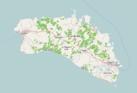
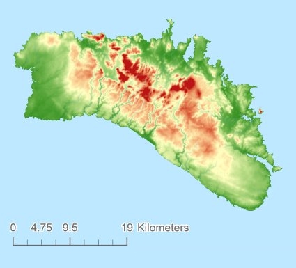
Topographic islandmap Menorca © OpenStreetMap-auteurs, CC-BY-SA. Map Menorca Menorca views: 1902 Height map of Menorca |


