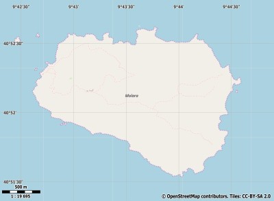
Description island MolaraThe inhabited small island of Molara is part of (the island group) and is located in the country of , Southern Europe. The distance to the mainland is about 202.8 km. The surface-area of the island is 3.5 km2 and is therefore 0.009 x times greater than the island of Isle of Wight. The island lies in the and the total coastal length is about 9.3 km and the dimensions of the island are approximately 2.6 km by 1.8 km (maximum width). The island is North-northwest - South-southeast oriented. The coordinates (latitude, longitude) of the island (center) for GPS are 40.87 (40°52'7.6440), 9.73 (9°43'39.0720).The population is 0 and the population density is thus on 0.00 inhabitants per square kilometer (compared Isle of Wight 364 inhabitants / km²). The island is located in the of the country . It is located in the administrative unit (local administrative level-name ), in the (local administrative level-name ). Direct neighboring islands of Molara are (distance from central part island to central part of the neighboring islands): 1) Sardinia Located 1.7 km WestSouthWest of the island. 2) Tavolara Located 2.2 km SouthEast of the island. 3) Caprera Located 38.5 km EastSouthEast of the island. 4) La maddalena Located 44.2 km EastSouthEast of the island. 5) Île Cavallo Located 65.8 km SouthEast of the island. 6) Corsica Located 68.5 km SouthEast of the island. 7) Asinara Located 117 km SouthSouthEast of the island. 8) Montecristo Located 166.6 km EastNorthEast of the island. 9) Del Giglio Located 188 km EastNorthEast of the island. 10) Giannutri Located 189.5 km NorthEast of the island. 11) Pianosa Located 190.1 km East of the island. 12) Elba Located 208.4 km East of the island. 13) Isola di San Pietro Located 221.5 km WestSouthWest of the island. 14) Isola di Sant'Antioco Located 224 km WestSouthWest of the island. 15) Capraia Located 236.1 km East of the island. 16) Isola Bisentina Located 261.4 km NorthEast of the island. 17) Isola Martana Located 261.6 km NorthEast of the island. 18) Palmarola Located 261.8 km North of the island. 19) Di Ponza Located 269.6 km North of the island. 20) Gavi Located 274.3 km North of the island. 21) Isola Zannone Located 278.5 km North of the island. 22) Gorgona Located 282.8 km East of the island. 23) Ventotene Located 309.2 km North of the island. 24) Santo Stefano Located 312.8 km North of the island. 25) Isola Polvese Located 318.3 km NorthEast of the island. The source material on the island consists of rocky surface. The land use on the island of Molara consists of To return to the overview page of this island click on the following link: Overview island Molara |
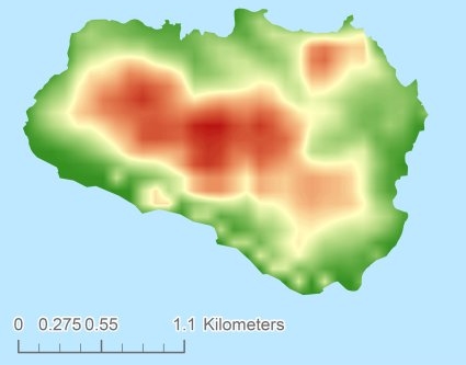
Topographic islandmap Molara © OpenStreetMap-auteurs, CC-BY-SA. Map Molara Molara views: 238 Height map of Molara |


