Description island MønThe inhabited large island of Møn is part of (the island group) and is located in the country of , Northern Europe. The distance to the mainland is about 45 km. The surface-area of the island is 220.3 km2 and is therefore 0.58 x times greater than the island of Isle of Wight. The island lies in the and the total coastal length is about 127.9 km and the dimensions of the island are approximately 30 km by 17.8 km (maximum width). The island is West-southwest - East-northeast oriented. The coordinates (latitude, longitude) of the island (center) for GPS are 54.98 (54°58'34.3632), 12.33 (12°19'53.1768).The population is 9385 and the population density is thus on 43.00 inhabitants per square kilometer (compared Isle of Wight 364 inhabitants / km²). The capital of the island is Stege (located in the Center of the island). Other places on the island are: . The island is located in the of the country . It is located in the administrative unit (local administrative level-name ), in the (local administrative level-name ). Direct neighboring islands of Møn are (distance from central part island to central part of the neighboring islands): 1) Bogø Located 0.1 km South of the island. 2) Nyord Located 0.2 km SouthSouthEast of the island. 3) Seeland Located 0.5 km East of the island. 4) Falster Located 0.8 km SouthWest of the island. 5) Lolland Located 21.1 km SouthSouthWest of the island. 6) Femø Located 34.9 km SouthSouthEast of the island. 7) Fejø Located 40.6 km South of the island. 8) Rügen Located 55.2 km NorthWest of the island. 9) Amager Located 58.7 km EastNorthEast of the island. 10) Agersø Located 63.1 km SouthSouthEast of the island. 11) Omø Located 64.5 km SouthSouthEast of the island. 12) Saltholm Located 67.6 km EastNorthEast of the island. 13) Fehmarn Located 71.6 km SouthWest of the island. 14) Langeland Located 77 km SouthSouthEast of the island. 15) Orø Located 81.8 km EastSouthEast of the island. 16) Funen Located 87.5 km SouthSouthEast of the island. 17) Tåsinge Located 90.7 km South of the island. 18) Ven Located 96.5 km EastNorthEast of the island. 19) Ærø Located 100.5 km South of the island. 20) Poel Located 104.5 km WestSouthWest of the island. 21) Sejerø Located 109.3 km SouthEast of the island. 22) Usedom Located 116.9 km NorthWest of the island. 23) Lyø Located 123.9 km South of the island. 24) Samsø Located 129.7 km SouthEast of the island. 25) Als Located 130.2 km South of the island. The source material on the island consists of sand. The land use on the island of Møn consists of wood 19 km2 (9%), nature 2.5 km2 (1%), wet nature 4.8 km2 (2%), and agriculture 181.4 km2 (82%), To return to the overview page of this island click on the following link: Overview island Møn |
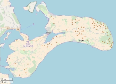
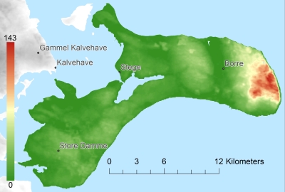
Topographic islandmap Møn © OpenStreetMap-auteurs, CC-BY-SA. Map Møn Møn views: 259 Height map of Møn |


