Description island Nisida MykonosThe inhabited fairly large island of Nisida Mykonos (local name Μύκονος) is part of (the island group) Cyclades and is located in the country of Greece, Southern Europe. The distance to the mainland is about 111.3 km. The surface-area of the island is 86.7 km2 and is therefore 0.228 x times greater than the island of Isle of Wight. The island lies in the Aegean Sea and the total coastal length is about 77 km and the dimensions of the island are approximately 15 km by 10.5 km (maximum width). The island is West - East oriented. The highest point is 375 meter and is named Profitis Ilias Vorniotis. The coordinates (latitude, longitude) of the island (center) for GPS are 37.45 (37°27'13.2876), 25.37 (25°22'23.3076).The population is 9320 and the population density is thus on 89.00 inhabitants per square kilometer (compared Isle of Wight 364 inhabitants / km²). The capital of the island is Mykonos - stad (located in the West of the island). Other places on the island are: Ornos, Plati Gialos, Faros Armenistis, Marathi, Klouvas, Ano Mera, Kalafati, Plintri, Elia. The island is located in the East-southeast of the country Greece. It is located in the administrative unit Region South Aegean (local administrative level-name Periféreia - περιοχή ), in the Regional unit Cyclades (local administrative level-name Nomos - Πειραιάς). Direct neighboring islands of Mikonos are (distance from central part island to central part of the neighboring islands): 1) Tinos Located 8.5 km SouthEast of the island. 2) Naxos Located 26.2 km WestNorthWest of the island. 3) Paros Located 27.8 km West of the island. 4) Syros Located 29.1 km South of the island. 5) Andros Located 37.4 km SouthEast of the island. 6) Antiparos Located 43.7 km WestSouthWest of the island. 7) Ikaria Located 45.6 km North of the island. 8) Hoog Koufonissi Located 54.5 km WestNorthWest of the island. 9) Laag Koufonissi Located 57.2 km WestNorthWest of the island. 10) Ios Located 67.7 km West of the island. 11) Sifnos Located 67.7 km SouthWest of the island. 12) Kythnos Located 72.1 km South of the island. 13) Serifos Located 72.2 km SouthSouthWest of the island. 14) Amorgos Located 73.5 km NorthWest of the island. 15) Sikinos Located 77 km West of the island. 16) Kea Located 81.2 km SouthSouthEast of the island. 17) Euboea Located 85.7 km SouthEast of the island. 18) Chios Located 89 km EastNorthEast of the island. 19) Kimolos Located 89 km SouthWest of the island. 20) Fournoi Located 90.1 km North of the island. 21) Folegandros Located 90.7 km WestSouthWest of the island. 22) Patmos Located 95.3 km North of the island. 23) Milos Located 98.3 km SouthWest of the island. 24) Samos Located 101.6 km NorthNorthEast of the island. 25) Santorini Located 102.4 km West of the island. Note: The information described below is partly subject to change. The island is directly accessible from Western Europe by plane. An international airport is present on the island. The island is accessible by car (by means of ferry or bridge). The distance from Western-Europe (The Netherlands) is about 2945 km. There is a ferry connection for cars to the mainland. For pedestrians, there is a ferry connection to the mainland also. There are ferry connections with car to other (neighboring) island (s). There are also (seasonal) ferry connections for pedestrians (-cyclists) with other (neighboring) island(s). Far as is known, there are good cycling opportunities on the island. To return to the overview page of this island click on the following link: Overview island Nisida Mykonos |
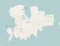
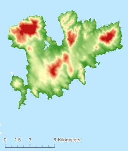
Topographic islandmap Nisida Mykonos © OpenStreetMap-auteurs, CC-BY-SA. Map Mikonos Nisida Mykonos views: 879 Height map of Nisida Mykonos |


