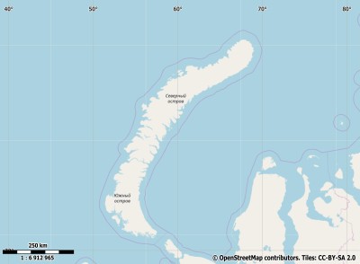
Description island Новая ЗемляThe inhabited very large island of Новая Земля is part of (the island group) and is located in the country of , Eastern Europe. The distance to the mainland is about 150 km. The surface-area of the island is 80302.9 km2 and is therefore 211.5 x times greater than the island of Isle of Wight. The island lies in the and the total coastal length is about 6972.6 km and the dimensions of the island are approximately 820.8 km by 255 km (maximum width). The island is Southwest - Northeast oriented. The coordinates (latitude, longitude) of the island (center) for GPS are 75.79 (75°47'33.1080), 61.35 (61°21'15.7680).The population is 2429 and the population density is thus on 0.03 inhabitants per square kilometer (compared Isle of Wight 364 inhabitants / km²). The island is located in the of the country . It is located in the administrative unit (local administrative level-name ), in the (local administrative level-name ). Direct neighboring islands of Nova Zembla are (distance from central part island to central part of the neighboring islands): 1) Vaygach Located 38.6 km NorthNorthWest of the island. 2) Kolguyev Located 212.9 km SouthWest of the island. 3) Franz Josef Land Located 364.4 km EastSouthEast of the island. 4) Morzhovets Located 626.5 km SouthWest of the island. 5) Spitsbergen Located 739.3 km SouthEast of the island. 6) Magerøya Located 893 km South of the island. 7) Måsøya Located 934.3 km South of the island. 8) Hjelmsøya Located 939.1 km South of the island. 9) Solovetsky Islands Located 944.4 km SouthWest of the island. 10) Havøya Located 947.5 km South of the island. 11) Reinøya Located 953.2 km South of the island. 12) Ingøya Located 964.2 km South of the island. 13) Reinøya Located 965.6 km South of the island. 14) Rolvsøya Located 965.6 km South of the island. 15) Kvaløya Located 981.3 km South of the island. 16) Sørøya Located 996.6 km South of the island. 17) Seiland Located 1001.2 km South of the island. 18) Kiy Located 1003.6 km SouthWest of the island. 19) Stjernøya Located 1034.3 km South of the island. 20) Silda Located 1073.3 km South of the island. 21) Arnøya Located 1114.2 km South of the island. 22) Uløya Located 1130.3 km South of the island. 23) Vanna Located 1142.5 km South of the island. 24) Reinøya Located 1156.8 km South of the island. 25) Helgøya Located 1160.9 km South of the island. The source material on the island consists of rocky surface. The land use on the island of Nova Zembla consists of To return to the overview page of this island click on the following link: Overview island Новая Земля |
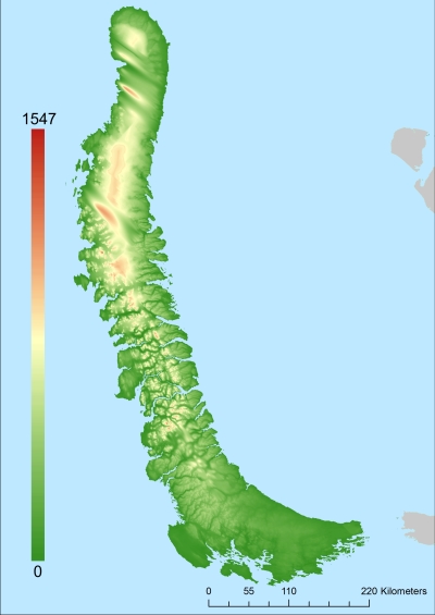
Topographic islandmap Новая Земля © OpenStreetMap-auteurs, CC-BY-SA. Map Nova Zembla Новая Земля views: 173 Height map of Новая Земля |


