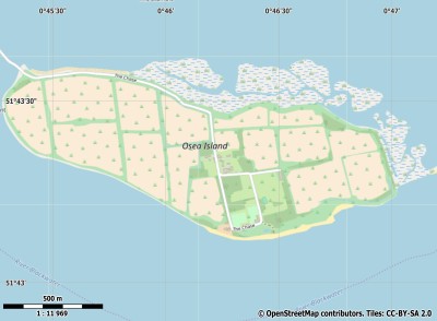
Description island Osea IslandThe inhabited very small island of Osea Island is part of (the island group) and is located in the country of , Western Europe. The distance to the mainland is, quite close about 0.6 km. The surface-area of the island is 1.5 km2 and is therefore 0.004 x times greater than the island of Isle of Wight. The island lies in the and the total coastal length is about 5.4 km and the dimensions of the island are approximately 2.1 km by 0.80 km (maximum width). The island is West-northwest - East-southeast oriented. The coordinates (latitude, longitude) of the island (center) for GPS are 51.72 (51°43'2.1558), 0.77 (0°46'14.0052).The population is 20 and the population density is thus on 15.00 inhabitants per square kilometer (compared Isle of Wight 364 inhabitants / km²). Other places on the island are: The Chase. The island is located in the of the country . It is located in the administrative unit (local administrative level-name ), in the (local administrative level-name ). Direct neighboring islands of Osea Island are (distance from central part island to central part of the neighboring islands): 1) Isle of Wight Located 171.3 km SouthWest of the island. 2) Schutteplaat Located 200.1 km North of the island. 3) Werkeiland Neeltje Jans Located 200.2 km North of the island. 4) Mosselplaat Located 200.5 km North of the island. 5) Haringvreter Located 201.3 km North of the island. 6) Soelekerkeplaat Located 202 km North of the island. 7) Aardbeieneiland Located 202.2 km North of the island. 8) Arneplaat Located 202.4 km North of the island. 9) Roggenplaat Located 202.7 km North of the island. 10) Oranjeplaat Located 203.1 km North of the island. 11) Bastiaan de Langeplaat Located 203.8 km North of the island. 12) Zandkreekplaat Located 204.3 km North of the island. 13) Middelplaten West Located 206.5 km North of the island. 14) Middelplaten Oost Located 207.5 km North of the island. 15) Schelphoekplaten Located 208.5 km North of the island. 16) Ossehoek Located 213.5 km North of the island. 17) Hompelvoet Located 214.9 km North of the island. 18) Dwars in den Weg Located 215.9 km North of the island. 19) Stampersplaat Located 217.6 km North of the island. 20) Stampersplaat Zuid Located 218.7 km North of the island. 21) Markenje Located 219.1 km North of the island. 22) Veermansplaat Located 220.5 km North of the island. 23) Brownsea Island Located 221.3 km SouthSouthWest of the island. 24) Kabeljauwplaat Located 222 km North of the island. 25) Slijkplaat Located 231.6 km North of the island. The source material on the island consists of clay. The land use on the island of Osea Island consists of wet nature 0.4 km2 (31%), and agriculture 0.9 km2 (69%), To return to the overview page of this island click on the following link: Overview island Osea Island |
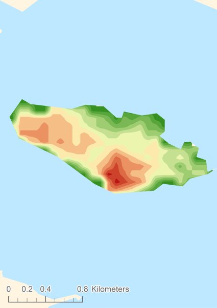
Topographic islandmap Osea Island © OpenStreetMap-auteurs, CC-BY-SA. Map Osea Island Osea Island views: 233 Height map of Osea Island |


