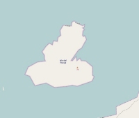
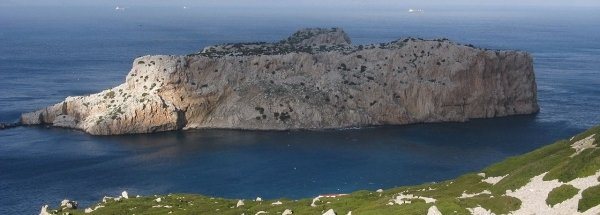
Description island Perejil IslandThe uninhabited very small island of Perejil Island (local name Isla de Perejil) is part of (the island group) Plazas de soberanía - Plazas menores and is located in the country of Spain, Southern Europe. The nearest (main) land is Marocco and is not the country to which the island belongs. The surface-area of the island is 0.130 km2 and is therefore 0 x times greater than the island of Isle of Wight. The island lies in the Street of Gibraltar and the total coastal length is about 1.6 km and the dimensions of the island are approximately 0.48 km by 0.48 km (maximum width). The island is North - South oriented. The highest point is 74 meter. The coordinates (latitude, longitude) of the island (center) for GPS are 35.91 (35°54'50.0004), -5.42 (-5°25'6.2184).It is located in the administrative unit Autonomous Community Andalusia (local administrative level-name Comunidad autónoma), in the Province Cádiz (local administrative level-name Provincia). Direct neighboring islands of Peterselie-eiland are (distance from central part island to central part of the neighboring islands): 1) Peñon de Vélez de la Gomera Located 130.4 km NorthWest of the island. 2) Peñon de Alhucemas Located 158.6 km NorthNorthWest of the island. 3) Isla de Alboran Located 214.7 km North of the island. 4) Isla del Congreso Located 281.4 km NorthNorthWest of the island. 5) Isla de Isabel II Located 282.4 km NorthNorthWest of the island. 6) Isla del Rey Located 283 km NorthNorthWest of the island. 7) Isla Mayor o del Baron Located 458.7 km NorthNorthEast of the island. 8) Tabarca Located 504.8 km NorthNorthEast of the island. 9) Benidorm Island Located 549.8 km NorthEast of the island. 10) Vedrà Located 669.9 km NorthNorthEast of the island. 11) Ibiza Located 673.1 km NorthNorthEast of the island. 12) Formentera Located 674.6 km NorthNorthEast of the island. 13) Conejera Located 677.4 km NorthNorthEast of the island. 14) Espalmador Located 683.7 km NorthNorthEast of the island. 15) Espardell Located 688.8 km NorthNorthEast of the island. 16) Islas Columbretes Located 694.6 km NorthEast of the island. 17) Tagomago Located 713.4 km NorthNorthEast of the island. 18) Isla de San Martiño o del Sur Located 758.5 km EastSouthEast of the island. 19) Islas Cies Located 761.2 km EastSouthEast of the island. 20) Isla de Ons Located 776.7 km EastSouthEast of the island. 21) Isla de La Toja Located 786.5 km EastSouthEast of the island. 22) Isla de Salvora Located 790.1 km EastSouthEast of the island. 23) Isla de Arosa Located 791.5 km EastSouthEast of the island. 24) Dragonera Located 791.9 km NorthEast of the island. 25) Mallorca Located 794.2 km NorthNorthEast of the island. To return to the overview page of this island click on the following link: Overview island Perejil Island |
Topographic islandmap Perejil Island © OpenStreetMap-auteurs, CC-BY-SA. Map Peterselie-eiland Perejil Island views: 830 |


