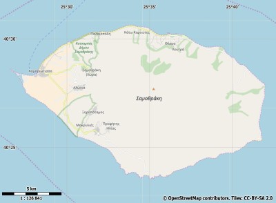
Description island ΣαμοθράκηThe inhabited fairly large island of Σαμοθράκη is part of (the island group) and is located in the country of , Southern Europe. The distance to the mainland is about 36.1 km. The surface-area of the island is 181.4 km2 and is therefore 0.478 x times greater than the island of Isle of Wight. The island lies in the and the total coastal length is about 59.1 km and the dimensions of the island are approximately 20.1 km by 13.7 km (maximum width). The island is South-southwest - North-northeast oriented. The coordinates (latitude, longitude) of the island (center) for GPS are 40.45 (40°27'1.9044), 25.59 (25°35'38.0004).The population is 2859 and the population density is thus on 16.00 inhabitants per square kilometer (compared Isle of Wight 364 inhabitants / km²). Other places on the island are: Kamariotissa (W), Paleopoli (NW), Lakkoma (ZZW), Therma (N), Perasmata (O), Akra Akrotiri. The island is located in the of the country . It is located in the administrative unit (local administrative level-name ), in the (local administrative level-name ). Direct neighboring islands of Samothraki are (distance from central part island to central part of the neighboring islands): 1) Limnos Located 41.2 km WestSouthWest of the island. 2) Thasos Located 58.4 km SouthSouthEast of the island. 3) Agios Efstratios Located 104 km WestSouthWest of the island. 4) Lesbos Located 122.7 km WestNorthWest of the island. 5) Kyra Panagia Located 169.3 km SouthWest of the island. 6) Skyros Located 182.1 km WestSouthWest of the island. 7) Alonnisos Located 182.7 km SouthWest of the island. 8) Psara Located 198 km West of the island. 9) Chios Located 201.7 km West of the island. 10) Skopelos Located 206.2 km SouthWest of the island. 11) Nisida Skiauos Located 218.7 km SouthWest of the island. 12) Euboea Located 228.1 km WestSouthWest of the island. 13) Andros Located 274.5 km WestSouthWest of the island. 14) Samos Located 302.9 km WestNorthWest of the island. 15) Tinos Located 305.1 km West of the island. 16) Ikaria Located 307.1 km WestNorthWest of the island. 17) Fournoi Located 314 km WestNorthWest of the island. 18) Kea Located 318.5 km WestSouthWest of the island. 19) Salamina Located 319.3 km SouthWest of the island. 20) Nisida Mykonos Located 321.8 km West of the island. 21) Syros Located 325.2 km West of the island. 22) Kythnos Located 337.9 km WestSouthWest of the island. 23) Aigina Located 338.9 km WestSouthWest of the island. 24) Patmos Located 344.3 km WestNorthWest of the island. 25) Naxos Located 354 km West of the island. To return to the overview page of this island click on the following link: Overview island Σαμοθράκη |
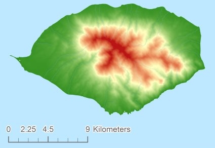
Topographic islandmap Σαμοθράκη © OpenStreetMap-auteurs, CC-BY-SA. Map Samothraki Σαμοθράκη views: 206 Height map of Σαμοθράκη |


