Description island SeilThe inhabited small island of Seil is part of (the island group) and is located in the country of , Western Europe. The distance to the mainland is, quite close about 0.1 km. The surface-area of the island is 13.3 km2 and is therefore 0.035 x times greater than the island of Isle of Wight. The island lies in the and the total coastal length is about 27.9 km and the dimensions of the island are approximately 7.3 km by 3.7 km (maximum width). The island is West-southwest - East-northeast oriented. The coordinates (latitude, longitude) of the island (center) for GPS are 56.3 (56°1'47.1432), -5.62 (-5°37'8.6844).The population is 551 and the population density is thus on 41.40 inhabitants per square kilometer (compared Isle of Wight 364 inhabitants / km²). Other places on the island are: Cuan. The island is located in the of the country . It is located in the administrative unit (local administrative level-name ), in the (local administrative level-name ). Direct neighboring islands of Seil are (distance from central part island to central part of the neighboring islands): 1) Luing Located 0.3 km SouthSouthWest of the island. 2) Kerrera Located 5.1 km EastNorthEast of the island. 3) Mull Located 6.8 km SouthEast of the island. 4) Scarba Located 8.3 km WestSouthWest of the island. 5) Jura Located 13.8 km WestSouthWest of the island. 6) Lismore Located 14.9 km East of the island. 7) Colonsay Located 35.3 km SouthSouthWest of the island. 8) Ulva Located 35.7 km SouthSouthEast of the island. 9) Oronsay Located 45 km SouthWest of the island. 10) Iona Located 45.4 km South of the island. 11) Isle of Bute Located 46.6 km NorthWest of the island. 12) Islay Located 48.1 km SouthWest of the island. 13) Gigha Located 60 km West of the island. 14) Coll Located 63.4 km SouthSouthEast of the island. 15) Arran Located 64.4 km WestNorthWest of the island. 16) Muck Located 67.5 km SouthEast of the island. 17) Great Cumbrae Island Located 68.8 km NorthWest of the island. 18) Eigg Located 69.1 km EastSouthEast of the island. 19) Tiree Located 70.8 km SouthSouthEast of the island. 20) Rùm Located 80.4 km EastSouthEast of the island. 21) Skye Located 81.2 km EastSouthEast of the island. 22) Holy Island Located 87.9 km WestNorthWest of the island. 23) Soay Located 97.1 km EastSouthEast of the island. 24) Canna Located 97.5 km EastSouthEast of the island. 25) Scalpay Located 107.8 km EastSouthEast of the island. The source material on the island consists of rocky surface. The land use on the island of Seil consists of nature 2.9 km2 (22%), and agriculture 10 km2 (75%), To return to the overview page of this island click on the following link: Overview island Seil |
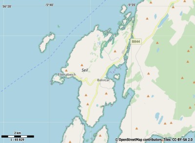
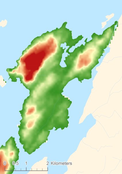
Topographic islandmap Seil © OpenStreetMap-auteurs, CC-BY-SA. Map Seil Seil views: 216 Height map of Seil |


