Description island SeilandThe inhabited large island of Seiland is part of (the island group) and is located in the country of , Northern Europe. The distance to the mainland is, quite close about 2.1 km. The surface-area of the island is 545.7 km2 and is therefore 1.4 x times greater than the island of Isle of Wight. The island lies in the and the total coastal length is about 572.7 km and the dimensions of the island are approximately 39.4 km by 24 km (maximum width). The island is West-southwest - East-northeast oriented. The coordinates (latitude, longitude) of the island (center) for GPS are 70.45 (70°26'4.3314), 23.3 (23°1'46.7112).The population is 0 and the population density is thus on 0.00 inhabitants per square kilometer (compared Isle of Wight 364 inhabitants / km²). The island is located in the of the country . It is located in the administrative unit (local administrative level-name ), in the (local administrative level-name ). Direct neighboring islands of Seiland are (distance from central part island to central part of the neighboring islands): 1) Kvaløya Located 0.9 km NorthEast of the island. 2) Stjernøya Located 1.4 km West of the island. 3) Sørøya Located 3.5 km SouthEast of the island. 4) Reinøya Located 34.3 km NorthEast of the island. 5) Rolvsøya Located 36.4 km EastNorthEast of the island. 6) Silda Located 38.4 km South of the island. 7) Ingøya Located 49.2 km EastNorthEast of the island. 8) Havøya Located 56.1 km NorthEast of the island. 9) Hjelmsøya Located 61.7 km NorthEast of the island. 10) Reinøya Located 63.2 km NorthNorthWest of the island. 11) Måsøya Located 66.1 km NorthEast of the island. 12) Magerøya Located 76.6 km NorthEast of the island. 13) Arnøya Located 78.9 km SouthSouthWest of the island. 14) Uløya Located 96.1 km SouthSouthWest of the island. 15) Vanna Located 107.1 km SouthSouthWest of the island. 16) Reinøya Located 121.1 km SouthSouthWest of the island. 17) Helgøya Located 126.4 km SouthSouthWest of the island. 18) Ringvassøya Located 127.4 km SouthSouthWest of the island. 19) Rebbenesøya Located 149.3 km SouthSouthWest of the island. 20) Kvaløya Located 159.4 km SouthSouthWest of the island. 21) Senja Located 208.7 km SouthSouthWest of the island. 22) Dyrøya Located 249.2 km SouthSouthWest of the island. 23) Andørja Located 267.5 km SouthWest of the island. 24) Rolla Located 282.1 km SouthWest of the island. 25) Andøya Located 283.4 km SouthSouthWest of the island. The source material on the island consists of rocky surface. The land use on the island of Seiland consists of Sand - Rock 176.6 km2 (32%), wood 41.2 km2 (8%), nature 326 km2 (60%), To return to the overview page of this island click on the following link: Overview island Seiland |
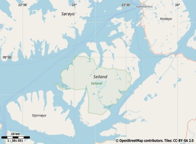
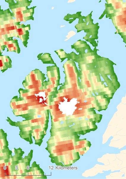
Topographic islandmap Seiland © OpenStreetMap-auteurs, CC-BY-SA. Map Seiland Seiland views: 214 Height map of Seiland |


