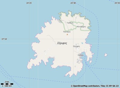
Description island ΣέριφοςThe inhabited fairly large island of Σέριφος is part of (the island group) and is located in the country of , Southern Europe. The distance to the mainland is about 62.5 km. The surface-area of the island is 74 km2 and is therefore 0.195 x times greater than the island of Isle of Wight. The island lies in the and the total coastal length is about 68.3 km and the dimensions of the island are approximately 11 km by 10.7 km (maximum width). The island is West - East oriented. The coordinates (latitude, longitude) of the island (center) for GPS are 37.16 (37°9'37.7208), 24.48 (24°28'51.5784).The population is 1420 and the population density is thus on 19.00 inhabitants per square kilometer (compared Isle of Wight 364 inhabitants / km²). Other places on the island are: Koutala, Sikamia, Kentarchos, Serifos, Megalo Livadi, Ganema,Livadi. The island is located in the of the country . It is located in the administrative unit (local administrative level-name ), in the (local administrative level-name ). Direct neighboring islands of Serifos are (distance from central part island to central part of the neighboring islands): 1) Kythnos Located 13 km EastSouthEast of the island. 2) Sifnos Located 13.4 km NorthWest of the island. 3) Kimolos Located 29.6 km WestNorthWest of the island. 4) Syros Located 35.7 km NorthNorthEast of the island. 5) Milos Located 37.6 km West of the island. 6) Kea Located 38.6 km EastSouthEast of the island. 7) Antiparos Located 45.4 km NorthNorthWest of the island. 8) Paros Located 51.2 km NorthNorthWest of the island. 9) Folegandros Located 58.3 km WestNorthWest of the island. 10) Tinos Located 64.1 km NorthEast of the island. 11) Andros Located 65.4 km NorthEast of the island. 12) Sikinos Located 69.7 km NorthWest of the island. 13) Naxos Located 71 km North of the island. 14) Nisida Mykonos Located 72.2 km NorthNorthEast of the island. 15) Ios Located 76.1 km NorthNorthWest of the island. 16) Ydra Located 77.9 km SouthSouthEast of the island. 17) Euboea Located 82.1 km East of the island. 18) Poros Located 88.9 km SouthSouthEast of the island. 19) Laag Koufonissi Located 94.1 km NorthNorthWest of the island. 20) Hoog Koufonissi Located 96 km NorthNorthWest of the island. 21) Aigina Located 98.4 km SouthEast of the island. 22) Santorini Located 104.4 km NorthWest of the island. 23) Salamina Located 113.2 km SouthEast of the island. 24) Amorgos Located 114.1 km NorthNorthWest of the island. 25) Monemvasia Located 130 km SouthSouthWest of the island. To return to the overview page of this island click on the following link: Overview island Σέριφος |
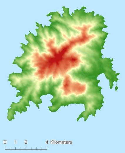
Topographic islandmap Σέριφος © OpenStreetMap-auteurs, CC-BY-SA. Map Serifos Σέριφος views: 227 Height map of Σέριφος |


