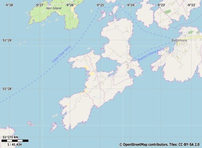
Description island SherkinThe inhabited small island of Sherkin is part of (the island group) and is located in the country of , Western Europe. The distance to the mainland is, quite close about 0.2 km. The surface-area of the island is 5.2 km2 and is therefore 0.014 x times greater than the island of Isle of Wight. The island lies in the and the total coastal length is about 23.8 km and the dimensions of the island are approximately 4.6 km by 2.4 km (maximum width). The island is South-southwest - North-northeast oriented. The coordinates (latitude, longitude) of the island (center) for GPS are 51.47 (51°28'16.7268), -9.42 (-9°24'56.0376).The population is 0 and the population density is thus on 0.00 inhabitants per square kilometer (compared Isle of Wight 364 inhabitants / km²). The island is located in the of the country . It is located in the administrative unit (local administrative level-name ), in the (local administrative level-name ). Direct neighboring islands of Sherkin are (distance from central part island to central part of the neighboring islands): 1) Hare Located 0.9 km SouthSouthEast of the island. 2) Clear Located 1.7 km SouthSouthWest of the island. 3) Long Located 7.6 km SouthSouthEast of the island. 4) Whiddy Located 21.8 km EastSouthEast of the island. 5) Bear Located 30.5 km SouthEast of the island. 6) Dursey Located 52.1 km SouthSouthEast of the island. 7) Valencia Located 76.6 km SouthEast of the island. 8) Skellig Rock Little Located 81.4 km SouthSouthEast of the island. 9) Skellig Rock Great Located 83 km SouthSouthEast of the island. 10) Great Blasket Located 101.5 km SouthEast of the island. 11) Inisheer Located 173.1 km East of the island. 12) Inishmaan Located 175.7 km East of the island. 13) Inishmore Located 178.5 km East of the island. 14) Gorumna Located 193.6 km East of the island. 15) Omey Located 231.9 km EastSouthEast of the island. 16) Inishbofin Located 241.3 km EastSouthEast of the island. 17) Clare Located 258.9 km East of the island. 18) Achill Located 267.8 km East of the island. 19) Bryher Located 272.2 km NorthWest of the island. 20) Tresco Located 272.5 km NorthWest of the island. 21) St Martins Located 274.9 km NorthWest of the island. 22) St Marys Located 277.1 km NorthWest of the island. 23) St Agnes Located 277.5 km NorthWest of the island. 24) Ramsey Island Located 282.7 km North of the island. 25) Skomer Island Located 284.1 km North of the island. The source material on the island consists of rocky surface. The land use on the island of Sherkin consists of wet nature 0.7 km2 (13%), and agriculture 4.3 km2 (84%), To return to the overview page of this island click on the following link: Overview island Sherkin |
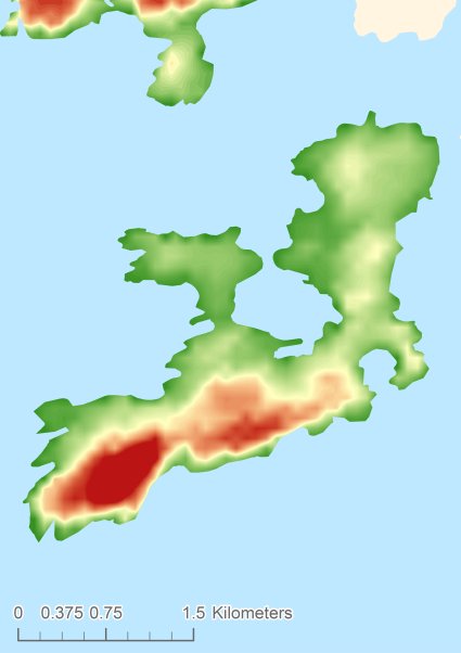
Topographic islandmap Sherkin © OpenStreetMap-auteurs, CC-BY-SA. Map Sherkin Sherkin views: 227 Height map of Sherkin |


