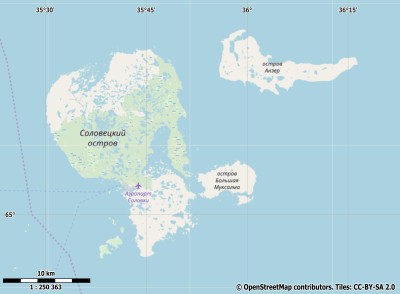
Description island Соловецкие островаThe inhabited large island of Соловецкие острова is part of (the island group) and is located in the country of , Eastern Europe. The distance to the mainland is about 21.5 km. The surface-area of the island is 347 km2 and is therefore 0.914 x times greater than the island of Isle of Wight. The island lies in the and the total coastal length is about 316.1 km and the dimensions of the island are approximately 35.8 km by 24.2 km (maximum width). The island is North-northwest - South-southeast oriented. The coordinates (latitude, longitude) of the island (center) for GPS are 65.08 (65°4'46.9920), 35.7 (35°42'13.1760).The population is 900 and the population density is thus on 259.00 inhabitants per square kilometer (compared Isle of Wight 364 inhabitants / km²). The capital of the island is Solovetsky (located in the Southwest of the island). Other places on the island are: Solovetsky (ZW), Rebalda (NO). The island is located in the of the country . It is located in the administrative unit (local administrative level-name ), in the (local administrative level-name ). Direct neighboring islands of Solovetski-eilanden are (distance from central part island to central part of the neighboring islands): 1) Kiy Located 142.2 km NorthWest of the island. 2) Kizhi Located 317.9 km West of the island. 3) Morzhovets Located 330.6 km NorthEast of the island. 4) Mantsinsaari Located 445.1 km WestSouthWest of the island. 5) Valaam Located 457.6 km WestSouthWest of the island. 6) Hailuoto Located 490.7 km South of the island. 7) Konevets Located 519.6 km WestSouthWest of the island. 8) Kataja Located 529.8 km SouthSouthEast of the island. 9) Seskarö Located 546.5 km SouthSouthEast of the island. 10) Rånön Located 583.8 km South of the island. 11) Beryozovye Islands Located 620.5 km SouthWest of the island. 12) Kotlin Located 626.2 km WestSouthWest of the island. 13) Kolguyev Located 658.9 km NorthEast of the island. 14) Seskar Located 662.7 km SouthWest of the island. 15) Enonsaari Located 669 km SouthWest of the island. 16) Moshchny Located 678.9 km SouthWest of the island. 17) Hogland Located 700 km SouthWest of the island. 18) Björkö Located 708.3 km South of the island. 19) Replot Located 711.9 km South of the island. 20) Reinøya Located 714.1 km EastSouthEast of the island. 21) Bolshoy Tyuters Located 714.1 km SouthWest of the island. 22) Holmön Located 714.3 km South of the island. 23) Emäsalo Located 727.9 km SouthWest of the island. 24) Magerøya Located 759.4 km EastSouthEast of the island. 25) Korkeasaari Located 761.8 km SouthWest of the island. The source material on the island consists of sand. The land use on the island of Solovetski-eilanden consists of To return to the overview page of this island click on the following link: Overview island Соловецкие острова |
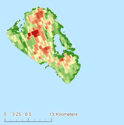
Topographic islandmap Соловецкие острова © OpenStreetMap-auteurs, CC-BY-SA. Map Solovetski-eilanden Соловецкие острова views: 202 Height map of Соловецкие острова |


