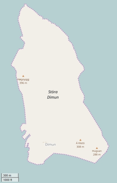
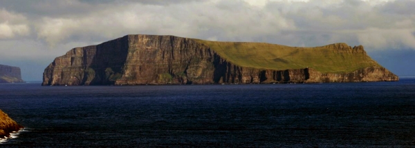
Description island Stóra DímunThe inhabited small island of Stóra Dímun is part of (the island group) and is located in the country of , Northern Europe. The distance to the mainland is about 354 km. The surface-area of the island is 2.9 km2 and is therefore 0.008 x times greater than the island of Isle of Wight. The island lies in the and the total coastal length is about 7.5 km and the dimensions of the island are approximately 2.8 km by 1.4 km (maximum width). The island is North-northwest - South-southeast oriented. The coordinates (latitude, longitude) of the island (center) for GPS are 61.69 (61°4'9.3972), -6.76 (-6°45'21.6792).The population is 9 and the population density is thus on 1.50 inhabitants per square kilometer (compared Isle of Wight 364 inhabitants / km²). The capital of the island is Stóra Dímun (located in the South of the island). Other places on the island are: Stóra Dímun (Z). The island is located in the of the country . It is located in the administrative unit (local administrative level-name ), in the (local administrative level-name ). Direct neighboring islands of Stóra Dímun are (distance from central part island to central part of the neighboring islands): 1) Skúvoy Located 5 km EastSouthEast of the island. 2) Lítla Dímun Located 5.2 km WestNorthWest of the island. 3) Sandoy Located 6.5 km EastNorthEast of the island. 4) Suðuroy Located 8.3 km SouthSouthWest of the island. 5) Hestur Located 25.6 km EastSouthEast of the island. 6) Streymoy Located 25.8 km East of the island. 7) Nólsoy Located 27.9 km EastNorthEast of the island. 8) Koltur Located 31.6 km EastSouthEast of the island. 9) Eysturoy Located 39.2 km East of the island. 10) Vágar Located 41.5 km EastSouthEast of the island. 11) Borðoy Located 52.7 km EastNorthEast of the island. 12) Kalsoy Located 57.9 km East of the island. 13) Mykines Located 59 km SouthEast of the island. 14) Kunoy Located 61.3 km East of the island. 15) Svínoy Located 62.1 km EastNorthEast of the island. 16) Viðoy Located 66 km EastNorthEast of the island. 17) Fugloy Located 72.1 km EastNorthEast of the island. 18) Foula Located 303.7 km NorthNorthWest of the island. 19) Mainland Shetland Located 305.7 km NorthNorthWest of the island. 20) Papa Stour Located 309 km NorthNorthWest of the island. 21) Muckle Roe Located 319.5 km NorthNorthWest of the island. 22) Yell Located 319.7 km NorthNorthWest of the island. 23) Vaila Located 323.3 km NorthNorthWest of the island. 24) Unst Located 325.9 km NorthNorthWest of the island. 25) Westray Located 330.2 km NorthWest of the island. The source material on the island consists of rocky surface. The land use on the island of Stóra Dímun consists of nature -9999 km2 (85%), and agriculture -9999 km2 (15%), To return to the overview page of this island click on the following link: Overview island Stóra Dímun |
Topographic islandmap Stóra Dímun © OpenStreetMap-auteurs, CC-BY-SA. Map Stóra Dímun Stóra Dímun views: 248 |


