Description island Sveti NikolaThe inhabited very small island of Sveti Nikola is part of (the island group) and is located in the country of , Southern Europe. The distance to the mainland is, quite close about 0.8 km. The surface-area of the island is 0.430 km2 and is therefore 0.001 x times greater than the island of Isle of Wight. The island lies in the and the total coastal length is about 5.5 km and the dimensions of the island are approximately 1.8 km by 0.40 km (maximum width). The island is Northwest - Southeast oriented. The coordinates (latitude, longitude) of the island (center) for GPS are 42.27 (42°15'56.9160), 18.85 (18°51'8.0640).The population is 0 and the population density is thus on 0.00 inhabitants per square kilometer (compared Isle of Wight 364 inhabitants / km²). The island is located in the of the country . It is located in the administrative unit (local administrative level-name ), in the (local administrative level-name ). Direct neighboring islands of Sveti Nikola are (distance from central part island to central part of the neighboring islands): 1) Sveta Neđelja Located 9.2 km NorthWest of the island. 2) Katič Located 9.4 km NorthWest of the island. 3) Sveti Marko Located 19.2 km SouthEast of the island. 4) Gospa od Milosti Located 20.6 km SouthEast of the island. 5) Mamula Located 27.3 km SouthSouthEast of the island. 6) Ada Bojana Located 58.9 km NorthWest of the island. 7) Kolocep Located 80.7 km SouthSouthEast of the island. 8) Lopud Located 84.8 km SouthSouthEast of the island. 9) Šipan Located 90.6 km SouthSouthEast of the island. 10) Mljet Located 101.4 km SouthSouthEast of the island. 11) Korcula Located 153 km SouthSouthEast of the island. 12) Hvar Located 165.2 km SouthEast of the island. 13) Lastovo Located 165.8 km SouthSouthEast of the island. 14) Brac Located 196.2 km SouthEast of the island. 15) Proizd Located 198.6 km SouthSouthEast of the island. 16) Palagruža Located 213.2 km South of the island. 17) Sveti Klement Located 223 km SouthSouthEast of the island. 18) Vis Located 229.6 km SouthSouthEast of the island. 19) Šolta Located 232.2 km SouthSouthEast of the island. 20) Ciovo Located 241.8 km SouthEast of the island. 21) Biševo Located 244.2 km SouthSouthEast of the island. 22) Isole Cheradi Located 245.2 km SouthWest of the island. 23) Drvenik Veli Located 254.1 km SouthSouthEast of the island. 24) Drvenik Mali Located 259.8 km SouthSouthEast of the island. 25) Isola di Capraia Located 274.6 km South of the island. The source material on the island consists of rocky surface. The land use on the island of Sveti Nikola consists of To return to the overview page of this island click on the following link: Overview island Sveti Nikola |
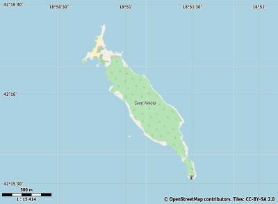
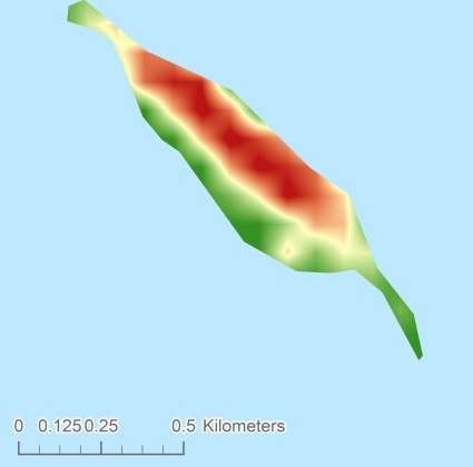
Topographic islandmap Sveti Nikola © OpenStreetMap-auteurs, CC-BY-SA. Map Sveti Nikola Sveti Nikola views: 208 Height map of Sveti Nikola |


