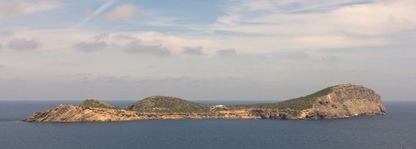
Description island TagomagoThe uninhabited very small island of Tagomago (local name Isla Tagomago) is part of (the island group) Balearic Islands and is located in the country of Spain, Southern Europe. The distance to the mainland is about 126.3 km. The surface-area of the island is 0.620 km2 and is therefore 0.002 x times greater than the island of Isle of Wight. The island lies in the Balearic Sea and the total coastal length is about 5.3 km and the dimensions of the island are approximately 1.5 km by 0.11 km (maximum width). The island is Northwest - Southeast oriented. The highest point is 86.3 meter and is named Tagomago. The coordinates (latitude, longitude) of the island (center) for GPS are 39.04 (39°2'11.4936), 1.64 (1°38'37.4028).It is located in the administrative unit Autonomous Community Balearic Islands (local administrative level-name Comunidad autónoma), in the Province Balearic Islands (local administrative level-name Provincia). Direct neighboring islands of Tagomago are (distance from central part island to central part of the neighboring islands): 1) Ibiza Located 1.5 km SouthSouthWest of the island. 2) Espardell Located 29 km WestSouthWest of the island. 3) Espalmador Located 32.4 km SouthWest of the island. 4) Formentera Located 34.2 km WestSouthWest of the island. 5) Conejera Located 36.8 km South of the island. 6) Vedrà Located 42.1 km SouthSouthWest of the island. 7) Dragonera Located 81.9 km NorthEast of the island. 8) Mallorca Located 82.5 km NorthEast of the island. 9) Cabrera Located 110 km North of the island. 10) Conejera Located 114.1 km North of the island. 11) Islas Columbretes Located 125 km SouthEast of the island. 12) Benidorm Island Located 164.6 km SouthSouthWest of the island. 13) Tabarca Located 207.2 km SouthSouthWest of the island. 14) Menorca Located 211.3 km NorthNorthEast of the island. 15) Illa den Colom Located 247.8 km NorthNorthEast of the island. 16) Isla Mayor o del Baron Located 257.3 km SouthWest of the island. 17) Medes Islands Located 359.3 km EastNorthEast of the island. 18) Isla de Alboran Located 537 km SouthWest of the island. 19) Pheasant Island Located 556.3 km EastSouthEast of the island. 20) Isla del Rey Located 559.3 km SouthWest of the island. 21) Île Pomègues Located 559.4 km EastNorthEast of the island. 22) Isla de Isabel II Located 559.6 km SouthWest of the island. 23) Isla del Congreso Located 560.4 km SouthWest of the island. 24) Île Ratonneau Located 561.3 km EastNorthEast of the island. 25) Santa Clara eiland Located 564.6 km EastSouthEast of the island. The land use on the island of Tagomago consists of nature 0.6 km2 (97%), To return to the overview page of this island click on the following link: Overview island Tagomago |
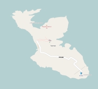
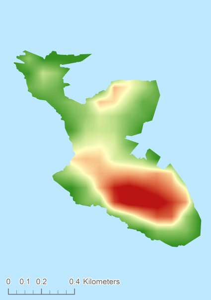
Topographic islandmap Tagomago © OpenStreetMap-auteurs, CC-BY-SA. Map Tagomago Tagomago views: 823 Height map of Tagomago |


