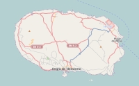
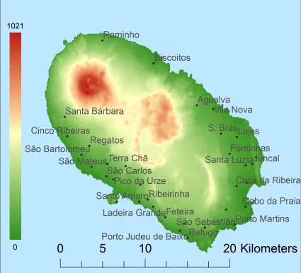
Description island TerceiraThe inhabited large island of Terceira is part of (the island group) Azores and is located in the country of Portugal, Southern Europe. The distance to the mainland is about 1518.9 km. The surface-area of the island is 400.6 km2 and is therefore 1.1 x times greater than the island of Isle of Wight. The island lies in the Atlantic Ocean and the total coastal length is about 116.6 km and the dimensions of the island are approximately 29.5 km by 16.4 km (maximum width). The island is West - East oriented. The highest point is 1021 meter and is named Santa Bárbara. The coordinates (latitude, longitude) of the island (center) for GPS are 38.72 (38°43'25.6692), -27.21 (-27°12'40.1472).The population is 56062 and the population density is thus on 139.40 inhabitants per square kilometer (compared Isle of Wight 364 inhabitants / km²). The capital of the island is Praia da Vitória (located in the East of the island). Other places on the island are: Angra do Heroismo (Z). The island is located in the West-northwest of the country Portugal. It is located in the administrative unit Autonomous Region Azores (local administrative level-name Região Autónoma), in the municipalites : 1) Praia da Vitória 2) Angra do Heroísmo (local administrative level-name Concelho). Direct neighboring islands of Terceira are (distance from central part island to central part of the neighboring islands): 1) São Jorge Located 37.8 km SouthSouthWest of the island. 2) Graciosa Located 56.6 km SouthSouthEast of the island. 3) Pico Located 65.7 km SouthSouthWest of the island. 4) Faial Located 107.3 km South of the island. 5) São Miguel Located 137.4 km NorthWest of the island. 6) Ilhéu de Vila Franca Located 176.8 km NorthWest of the island. 7) Santa Maria Located 247.5 km NorthWest of the island. 8) Flores Located 332.9 km SouthSouthEast of the island. 9) Corvo Located 336.1 km SouthSouthEast of the island. 10) Madeira Located 1097.1 km NorthNorthWest of the island. 11) Ilhas Desertas Located 1165.4 km NorthNorthWest of the island. 12) Ilhas Desertas Located 1167.1 km NorthNorthWest of the island. 13) Ilhas Desertas Located 1178.2 km NorthNorthWest of the island. 14) La Palma Located 1375.8 km NorthWest of the island. 15) El Hierro Located 1464.3 km NorthWest of the island. 16) La Gomera Located 1469.2 km NorthWest of the island. 17) Tenerife Located 1478.4 km NorthWest of the island. 18) Gran Canaria Located 1568.6 km NorthWest of the island. 19) Isla de Salvora Located 1577.5 km NorthNorthEast of the island. 20) Isla de Ons Located 1581.3 km NorthNorthEast of the island. 21) Islas Cies Located 1581.5 km NorthNorthEast of the island. 22) Isla de San Martiño o del Sur Located 1581.6 km NorthNorthEast of the island. 23) Isla de Arosa Located 1589.5 km NorthNorthEast of the island. 24) Isla de La Toja Located 1591.2 km NorthNorthEast of the island. 25) Isla Cortegada Located 1598.6 km NorthNorthEast of the island. Note: The information described below is partly subject to change. The island is directly accessible from Western Europe by plane. An international airport is present on the island. To return to the overview page of this island click on the following link: Overview island Terceira |
Topographic islandmap Terceira © OpenStreetMap-auteurs, CC-BY-SA. Map Terceira Terceira views: 2206 Height map of Terceira |


