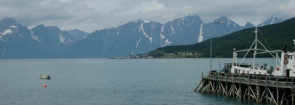
Description island UløyaThe inhabited fairly large island of Uløya is part of (the island group) and is located in the country of , Northern Europe. The distance to the mainland is, quite close about 1.1 km. The surface-area of the island is 77.2 km2 and is therefore 0.203 x times greater than the island of Isle of Wight. The island lies in the and the total coastal length is about 54.4 km and the dimensions of the island are approximately 13.9 km by 8.6 km (maximum width). The island is West - East oriented. The coordinates (latitude, longitude) of the island (center) for GPS are 69.85 (69°50'43.0008), 20.62 (20°37'2.3736).The population is 0 and the population density is thus on 0.00 inhabitants per square kilometer (compared Isle of Wight 364 inhabitants / km²). The island is located in the of the country . It is located in the administrative unit (local administrative level-name ), in the (local administrative level-name ). Direct neighboring islands of Uløya are (distance from central part island to central part of the neighboring islands): 1) Arnøya Located 13.9 km East of the island. 2) Reinøya Located 27.2 km SouthSouthEast of the island. 3) Vanna Located 27.6 km SouthEast of the island. 4) Ringvassøya Located 34.8 km SouthSouthEast of the island. 5) Helgøya Located 44 km SouthSouthEast of the island. 6) Silda Located 53.4 km NorthEast of the island. 7) Kvaløya Located 56.7 km South of the island. 8) Rebbenesøya Located 63.3 km SouthSouthEast of the island. 9) Stjernøya Located 76.4 km NorthEast of the island. 10) Sørøya Located 81.1 km NorthEast of the island. 11) Seiland Located 96.1 km NorthNorthEast of the island. 12) Senja Located 101.9 km SouthSouthWest of the island. 13) Kvaløya Located 132.3 km NorthNorthEast of the island. 14) Dyrøya Located 139.9 km SouthSouthWest of the island. 15) Andørja Located 158 km SouthWest of the island. 16) Rolvsøya Located 165 km NorthEast of the island. 17) Reinøya Located 166.6 km NorthEast of the island. 18) Rolla Located 172.6 km SouthWest of the island. 19) Ingøya Located 174.4 km NorthEast of the island. 20) Reinøya Located 174.9 km NorthNorthEast of the island. 21) Andøya Located 179.2 km SouthSouthWest of the island. 22) Grytøya Located 180.2 km SouthSouthWest of the island. 23) Havøya Located 187.6 km NorthEast of the island. 24) Hinnøya Located 188.8 km SouthSouthWest of the island. 25) Hjelmsøya Located 192.9 km NorthEast of the island. The source material on the island consists of rocky surface. The land use on the island of Uløya consists of Sand - Rock 11.5 km2 (15%), wood 18.6 km2 (24%), nature 45.8 km2 (59%), and agriculture 0.7 km2 (1%), To return to the overview page of this island click on the following link: Overview island Uløya |
|


