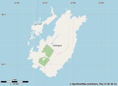
Description island UtlänganThe inhabited small island of Utlängan is part of (the island group) and is located in the country of , Northern Europe. The distance to the mainland is about 4.9 km. The surface-area of the island is 2.7 km2 and is therefore 0.007 x times greater than the island of Isle of Wight. The island lies in the and the total coastal length is about 11.5 km and the dimensions of the island are approximately 2.6 km by 1.8 km (maximum width). The island is South-southwest - North-northeast oriented. The coordinates (latitude, longitude) of the island (center) for GPS are 56.02 (56°1'25.2912), 15.79 (15°47'27.8304).The population is 0 and the population density is thus on 0.00 inhabitants per square kilometer (compared Isle of Wight 364 inhabitants / km²). The island is located in the of the country . It is located in the administrative unit (local administrative level-name ), in the (local administrative level-name ). Direct neighboring islands of Utlängan are (distance from central part island to central part of the neighboring islands): 1) Sturkö Located 6.7 km SouthEast of the island. 2) Aspö Located 15.7 km SouthSouthEast of the island. 3) Öland Located 40.9 km NorthNorthEast of the island. 4) Hanö Located 57.2 km South of the island. 5) Ivö Located 83.5 km South of the island. 6) Bornholm Located 101.7 km SouthWest of the island. 7) Bolmsö Located 159 km SouthEast of the island. 8) Gotland Located 173 km NorthEast of the island. 9) Ven Located 190.8 km South of the island. 10) Saltholm Located 191.8 km South of the island. 11) Seeland Located 196.3 km South of the island. 12) Amager Located 198.5 km SouthSouthWest of the island. 13) Hallands Väderö Located 203.2 km SouthSouthEast of the island. 14) Rügen Located 209.2 km SouthWest of the island. 15) Wolin Located 230.8 km WestSouthWest of the island. 16) Møn Located 234.1 km SouthSouthWest of the island. 17) Chrząszczewska Wyspa Located 236.2 km WestSouthWest of the island. 18) Visingsö Located 236.9 km EastSouthEast of the island. 19) Usedom Located 240.7 km WestSouthWest of the island. 20) Orø Located 247 km South of the island. 21) Nyord Located 247.5 km SouthSouthWest of the island. 22) Bogø Located 262.9 km SouthSouthWest of the island. 23) Falster Located 263.2 km SouthSouthWest of the island. 24) Anholt Located 265.8 km SouthSouthEast of the island. 25) Lolland Located 284.4 km SouthSouthWest of the island. The source material on the island consists of rocky surface. The land use on the island of Utlängan consists of nature 1.2 km2 (46%), and agriculture 1 km2 (37%), To return to the overview page of this island click on the following link: Overview island Utlängan |
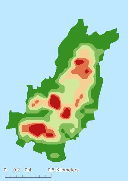
Topographic islandmap Utlängan © OpenStreetMap-auteurs, CC-BY-SA. Map Utlängan Utlängan views: 245 Height map of Utlängan |


